|
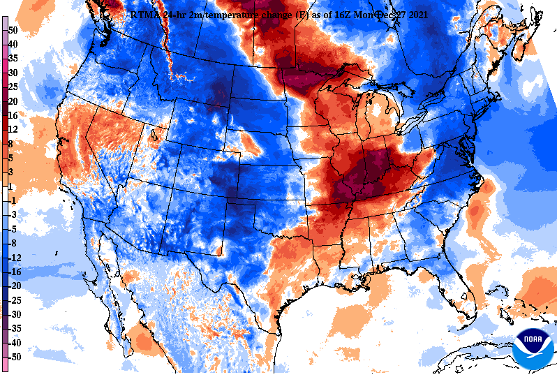
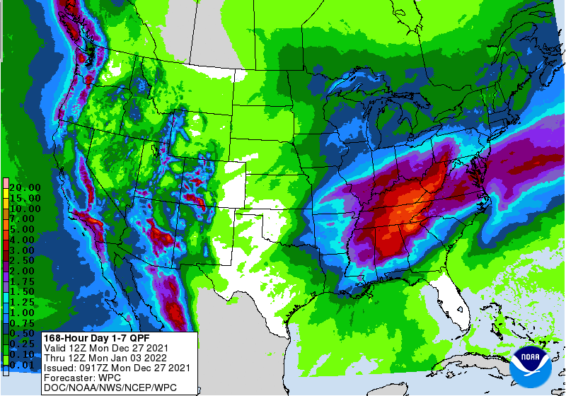
Good afternoon and I hope you're enjoying another Spring...whoops I mean Winter day. Looking across the Ohio Valley, temperatures have really warmed up over the past 24 hours. A northward moving warm front has lead to upwards of a 25 degree swing from this time yesterday for portions of Western Kentucky. Moving forward, anticipate the "heat" to stick around. Something we are closely monitoring is the flood threat not only midweek but also again this weekend. As the warm front continues to lift north, showers will arrive for Tuesday, with a cold front to then swing through on Wednesday. Because moderate to heavy showers are possible at times tomorrow and this will likely saturate grounds, a Marginal flash flooding risk has been placed from Wednesday morning into Thursday morning. The heaviest rainfall will be associated with the cold front Wednesday, with upwards of 2 inches or more will be possible with this system. Longer term, another similar setup is in place for New Year's weekend. We will continue to eye the potential for flooding, but this second wave could be a bit more hazardous than this first one. The graphic below highlights the 7-day rainfall expectations from the Weather Prediction Center (WPC). As you can see, upwards of 5 to 7 inches is anticipated through next Monday morning. Again, the greater half of this amount is expected from our second system Friday and this weekend. With moderate to heavy rainfall through midweek and only portions of Thursday and Friday to dry out, there is limited time for grounds to recover. Because of this and the heavy & consistent rainfall expected, flash flooding/flooding will be a concern. We will continue to provide more details in the days to come with the next system. For now, eyes are on our current one. Though the risk is low (5-10%), there is still concern for flash flood/flood prone areas across East Tennessee. If you are seeing flash flooding/flooding (particularly Wednesday), let us know via Twitter/Facebook or by email. Pre-recorded for 5pm show
0 Comments
Leave a Reply. |
Your trusted source for everything weather in East Tennessee.
Social Media
|


