|
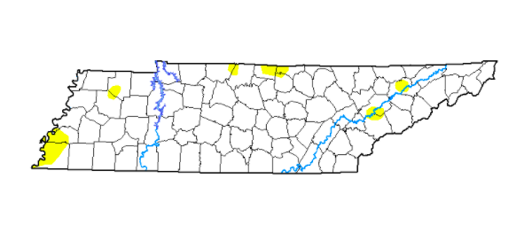
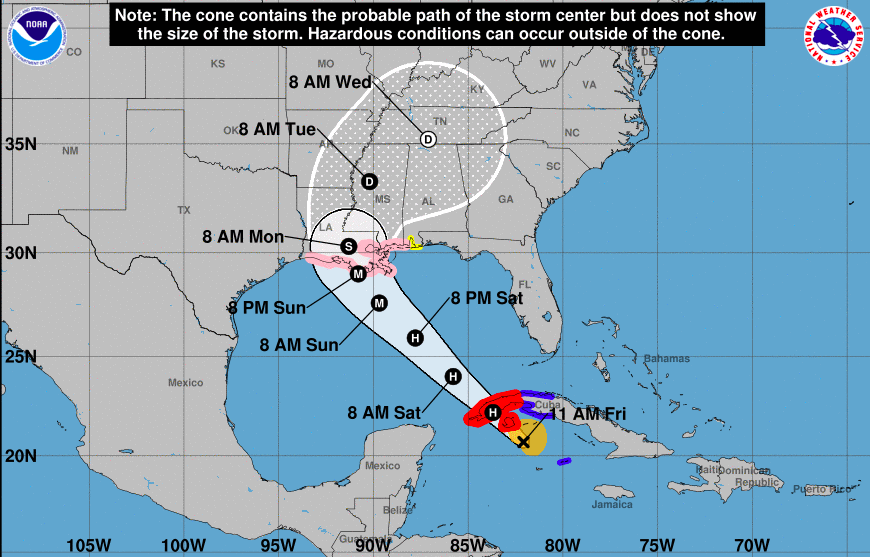
Good afternoon! We have finally made it to Friday and there is some good news to share. The dry conditions we once had, especially in our northeast, have greatly improved since last week. With the help of Fred, heavy rainfall brought conditions much closer to the norm. We are still seeing some abnormally dry spots here and there, but another round of Tropical moisture could be in the near-future. Looking at the latest from the NHC, now Hurricane Ida is expected to increase in strength to a MAJOR Hurricane. This means a category 3 or greater this weekend, before making landfall through the heart of Louisiana. Once making landfall (likely early Monday morning), it will pivot eastward, working towards TN. Given some uncertainty still after landfall, changes are likely, but Tropical moisture of some kind across the area is likely. This could again lead to flooding potential midweek, so check in for updates in the days ahead. Little changes are expected in the forecast this weekend and into early next week. The typical summer pattern with warm/muggy temps and pop up afternoon showers/storms can be expected. Stay cool, safe, and have a good weekend! Pre-recorded for 5pm show
0 Comments
Leave a Reply. |
Your trusted source for everything weather in East Tennessee.
Social Media
|


