|
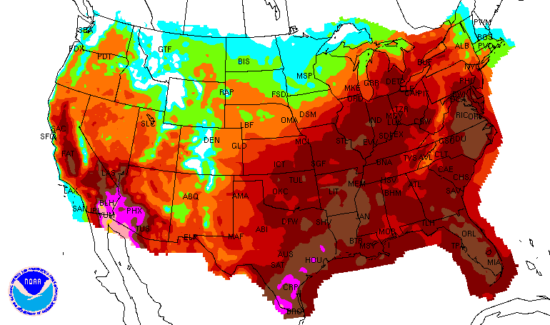
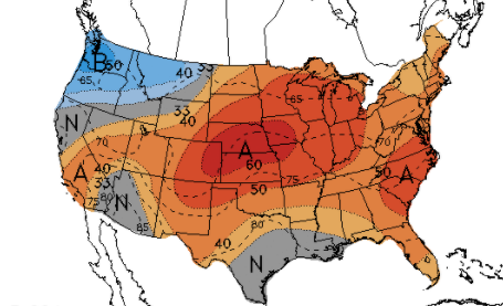
Good afternoon! Temperatures remain warm and muggy today but with the added cloud cover, we should top out a few degrees cooler. Looking into the heat index forecast tomorrow, the East Tennessee Valley will again see values near the 100 mark and the higher elevations around us in the mid 90s. Isolated showers/storms have already begun popping up this afternoon and will only becoming more widespread with time. These, again, will have the chance to provide heavy rainfall in slow moving cells. A few could even become severe for a short period of time, before raining themselves out. A mid-level wave will likely bring the best potentially for activity this afternoon. Ahead, summer-like activity continues. Pop up afternoon isolated showers/storms are possible each day. Longer term, the heat looks to continue. The CPC suggests above average temperatures through the end of August and into the first week of September. Rain also looks to be a bit less, at to slightly below the norm. This isn't surprising though, as we are beginning to transition to our driest months of the year. Something of note is Tropical Depression Number 9. This is currently southwest of Cuba and will strengthen with a northward push. Expectations are for this to be a hurricane by the weekend, eventually making landfall in the Gulf States (Mississippi, Louisiana, Alabama). We'll continue to keep a close eye on this, but let family/friends know what they could be in for by late weekend if in these areas. Pre-recorded for 5pm show
0 Comments
Leave a Reply. |
Your trusted source for everything weather in East Tennessee.
Social Media
|


