|
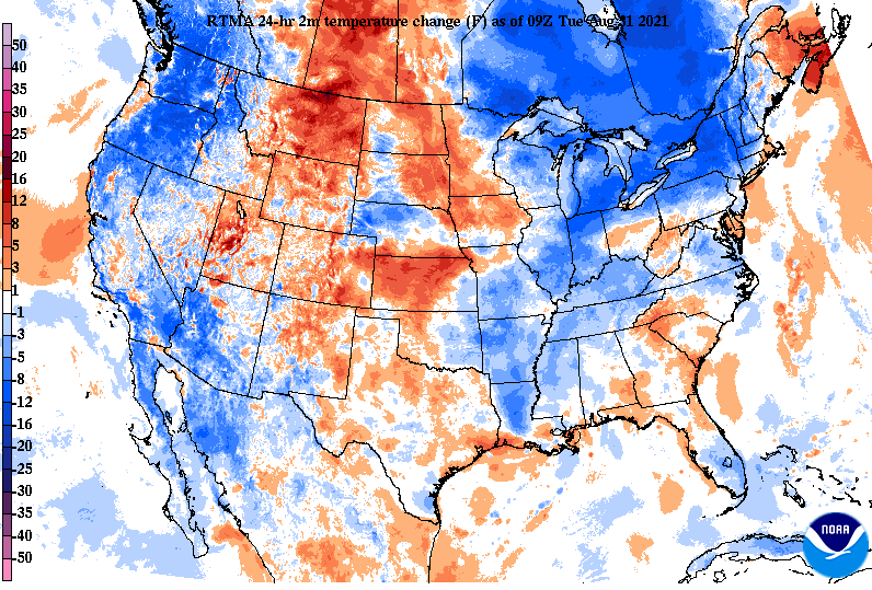
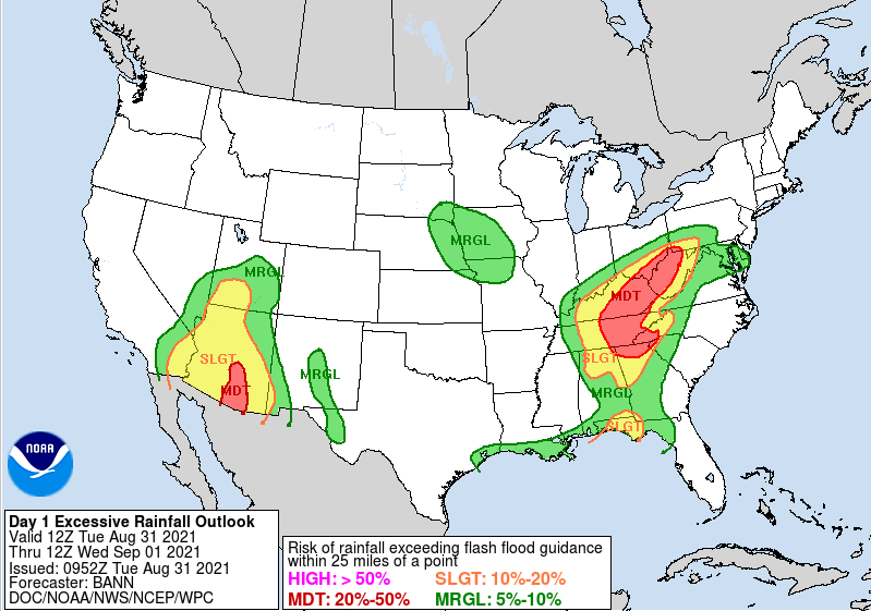
Good morning and I hope you are staying dry out there. The remnants of Ida will continue to charge its way through today, bringing the heaviest of the rainfall this evening and overnight. With the added cloud cover, rain cooled air, and cold front to the north, much cooler air has been seen across the Eastern CONUS. This will continue to be the trend ahead, as highs now through this weekend will be in the low to mid 80s. With Ida still to our south, heavy rainfall will continue today and tonight. As a result, the WPC has continued to leave Eastern TN and KY in a Moderate (20-50%) chance of flash flooding. This is 3 out of 4 on the categorical scale, so take action now if you are in flood prone areas, low-lying locations, or near water bodies. Let us know via email or social media what you are seeing across the area. These reports help us, the NWS, and others know what is going on and where. Looking at the play-by-play ahead, the tropical system will arrive by tonight, dumping heavy rainfall across the region. Anywhere from 1-2+ inches can be expected tonight alone, and that's on top of the roughly 1" through 7am this morning. The forecast remains fairly on track from yesterday as the rainfall breaks down as: Plateau & western valley: 3-5" TN Valley: 2-4" Foothills/Smokies: 1-3" Be sure to have a way to receive alerts/warnings as we progress through the day and into Wednesday. The good news is this system will ride a cold front north, bringing much drier and cooler air for us Thursday and to the weekend. Stay safe, stay dry, and prepare for more rainfall through the day and overnight. Bettering conditions are ahead, but we unfortunately likely have to deal with some flooding issues first. Pre-recorded for 5pm show
0 Comments
Leave a Reply. |
Your trusted source for everything weather in East Tennessee.
Social Media
|


