|
A low currently near the Great Lakes will bring showers and storms later today as a cold front sits to the west. The SPC has placed us under a Marginal Risk for severe storms, so a few could be strong to severe this evening and overnight. 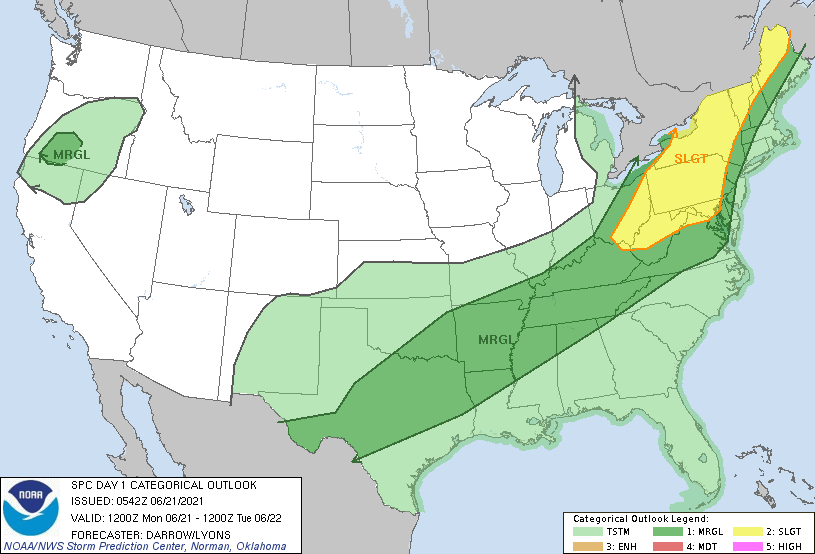 The bigger risk is the chance for flash flooding. The WPC has placed nearly the entire state under a Slight (10-20%) chance of flash flooding. As storms work through the latter half of today and into early Tuesday, heavy rainfall could lead to rising waters. Use caution and be aware of any watches or warnings that are issued. Estimate rainfall forecasts leave East Tennessee with 1 to 2 inches by Tuesday afternoon.  As we work ahead, this will be the main weather-player of the week. Not only will this system bring moderate to heavy rainfall, but also much cooler air by Tuesday afternoon. The cold front will knock temperatures down 10-15 degrees, as well as bring drier air back across the region. Following the cold front, sunny skies will pull us through the end of the work week where we could see isolated afternoon activity popping up Friday.  Though the severe threat is low, the risk for flash flooding is much better. Use caution, especially near water bodies, flood prone areas, and in low-lying locations. Send us reports via email ([email protected]), Twitter (@SecretCityWx) or Facebook (@SecretCityWx). Have a good one, be safe, and anticipate showers and storms developing later today and through Tuesday morning. Pre-recorded for 5pm show
0 Comments
Leave a Reply. |