|
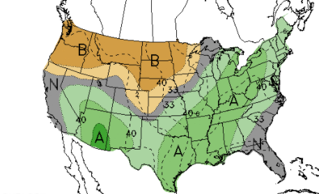
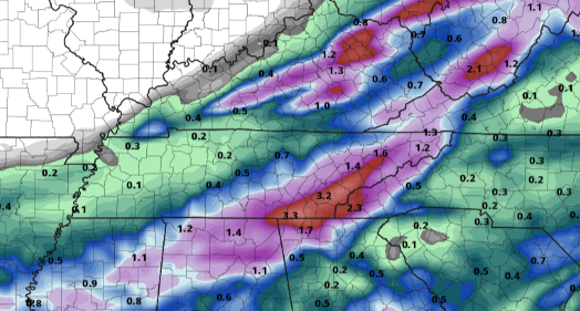
Good morning! It has been a cool but pleasant start to the day so far with light valley fog possible near water bodies. Over the Smokies, the skies are clear and the temperatures are cool. Newfound Gap sits at a temperatures of 50 degrees this morning. As we work forward, the CPC suggests above average rainfall for much of the eastern half of the US. We will begin to see some of this towards the weekend, but much better chances arrive next week as several waves arrive to the region. Looking at long-term data, parts of East Tennessee could receive upwards of 3 inches Friday through Tuesday. Comparing this one model to ensemble data (multiple models), The axis of heavy rainfall could set up further west, keeping East Tennessee on the drier side of weather. For now, the details remain fuzzy as guidance is having trouble pinpointing a solution. We also must account for the 5-7 day range of lead time. Another beautiful day is in the forecast, so take advantage while you can. High pressure will continue to shift eastward, allowing for return flow and building warmth. Highs Thursday and Friday will make a return to the mid and upper 80s, respectively. Find out more details by watching our video forecast below. Pre-recorded for 5pm show
0 Comments
Leave a Reply. |
Your trusted source for everything weather in East Tennessee.
Social Media
|


