|
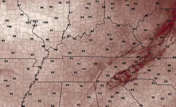
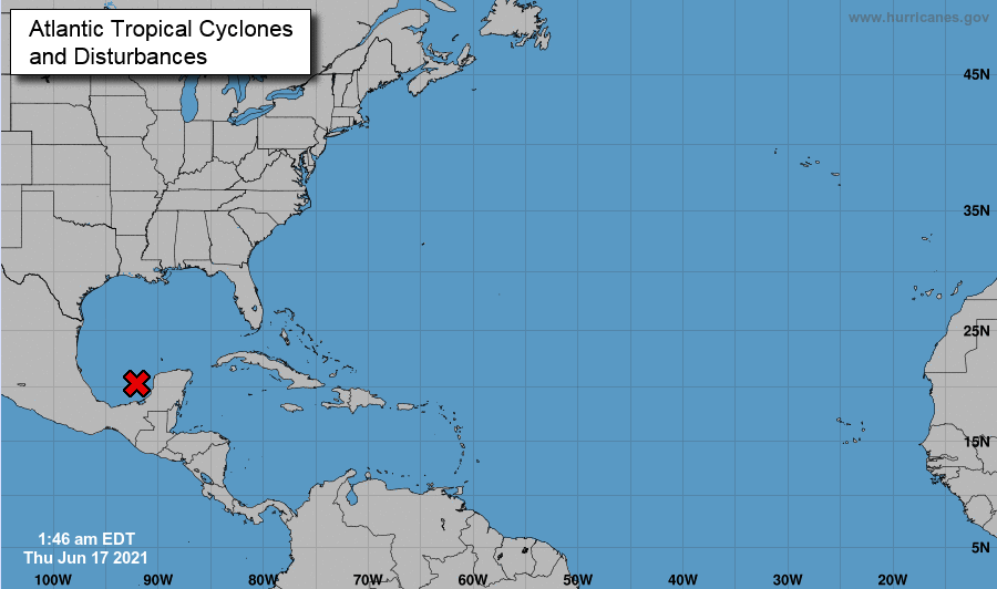
For some I can say it is a chilly morning. The Newfound Gap area of the Smokies is currently 49 degrees, while the valleys are sitting in the upper 50s. As we work through today, temperatures warm up a bit, but stay seasonable. For tomorrow, much warmer air is in store. Highs will range from the upper 80s to lower 90s, with some locations in the mid 90s. Check out our friends on the western side of the state where highs across the board will be in the mid 90s+. In addition to the heat for Friday, all eyes are pointed toward a tropical system expected to form into at least a depression by Friday. This will work north making landfall in the Panhandle this weekend. As it does so, we could see heavy rainfall with this system. There is still lots of details to be worked out with its exact path after landfall, but the model below in particular suggests heavy rainfall across East Tennessee. We will continue to keep you updated, but for now anticipate a chance to see tropical moisture across the Volunteer state. With high pressure in place and a low to the north, we will be wedged between two pressure masses. Because of this, anticipate to stay dry with cloud cover increasing through the afternoon and evening hours tomorrow. By Saturday, isolated showers will work in for the afternoon with scattered showers/storms Sunday. Again, depending on the path this tropical system takes will dictate how much rainfall we see for Monday and early next week. Enjoy the last bit of comfort. The heat and humidity work back in tomorrow bringing highs in the upper 80s and low 90s. Those further west will get it worst with highs in the mid to upper 90s. Stay cool, hydrated, and take breaks! Have a great Thursday. Pre-recorded for 5pm show
0 Comments
Leave a Reply. |
Your trusted source for everything weather in East Tennessee.
Social Media
|


