|
With lots to discuss, let's jump right into it. First, it is important to note we have released a HEAT ALERT for today (Monday) and Tuesday. This means abnormally high temperatures are expected across the east TN area. In addition to temperatures being in the mid 90's, the humidity will make temperatures feel close to 100 today and close to 110 tomorrow. With this said, PLEASE use caution if outdoors as heat exhaustion and stroke can strike quickly. Also, "look before you lock" as more than 30 children have already died in 2019 due to being left in hot vehicles. So why is it SO hot? Taking a look below is the current surface analysis graphic from the NWS. The high pressure system that has been keeping us dry this weekend has now pushed east. In return, the clock-wise flow allows for moisture to be pumped into our region (as shown by the arrows). With the combination of a dominate high pressure system and moisture being drawn in, temperatures are expected to feel in the triple digits through tomorrow. 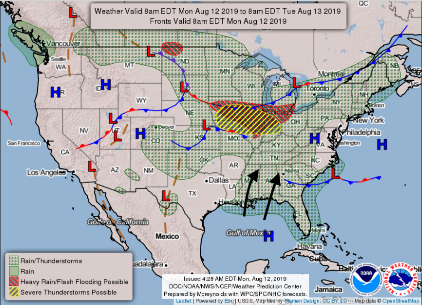 As an example, models are picking up on temperatures feeling close to 110 degrees for much of the valley by 4pm tomorrow afternoon. With these conditions, heat exhaustion and heat stroke can strike fast. Know the warning signs for each by referencing this site. 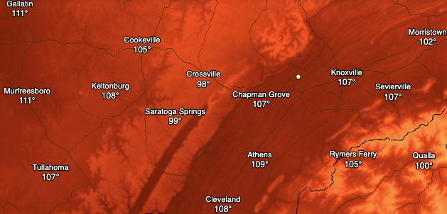 Courtesy of Dark Sky Beyond the temperature hazards, we could also see the chance for severe weather Tuesday night. Taking a look below, you can see a front moving through the area. With plentiful moisture and heat already in place, this front will provide additional forcing (creating an unstable atmosphere). As of now, it is hard to pick up on the exact timing and impacts. As we get into tomorrow, I will have a better idea on the variables going into the forecast. I will mention that the rain we do receive will be "spotty". What I mean is stronger storms will produce heavier rainfall in certain spots than in others. Overall, we are in need of rain and, unfortunately, this system will not be a good one for replenishing the whole area.  Current data has models suggesting a line of storms developing tomorrow night ahead of the front between 8 pm and 1 am. Depending on the exact time this forms, it can play a big factor in the severity. If this line forms early in the night (8pm or earlier) we could see a higher possibility of some severe weather. Another factor is cloud cover. Cloud cover will also play a part in temperatures tomorrow afternoon. If clouds arrive by tomorrow afternoon, temperatures could be a bit cooler (this is relative) than if they arrive later in the day. With all of this said, I would not be surprised to see NWS Morristown issue some Heat Advisories across the area, but again, this will depend largely on when clouds ahead of the front arrive.  Below is the latest Severe Prediction Center release depicting the east TN region under a slight risk for severe weather. This system is a bit complex and hard to forecast for a full 30+ hours in advance with so many variables not completely known. As of now, I do expect a line of storms to develop tomorrow evening/night with the chance of some severe warned storms. This line will develop to our north and depending on the variables and timing, could keep its "form" (linearity) through our area. The greatest impacts associated with this will be damaging winds, large hail, and isolated areas of heavy downpours within stronger thunderstorms. I will continue to monitor this system as it nears, so check back in tomorrow via Twitter and Facebook (@SecretCityWX). For those who do not have social media, you can follow along by viewing our tweets to the right of the screen. Simply scroll through or click on our twitter to view all of our content. 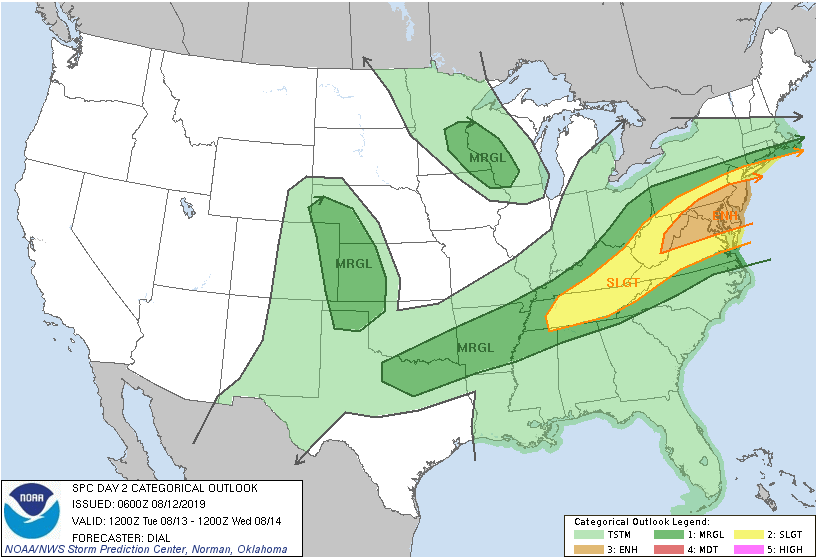 For some ways to beat the heat, check out our latest graphic below. I hope everyone has a good start to their work week and remember to continuously check back in with us for the latest on the heat and tomorrow's severe potential. 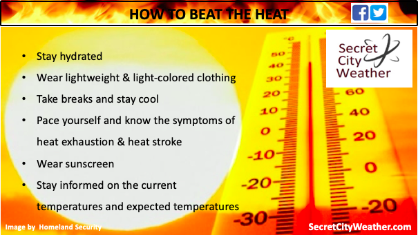
0 Comments
Leave a Reply. |