|
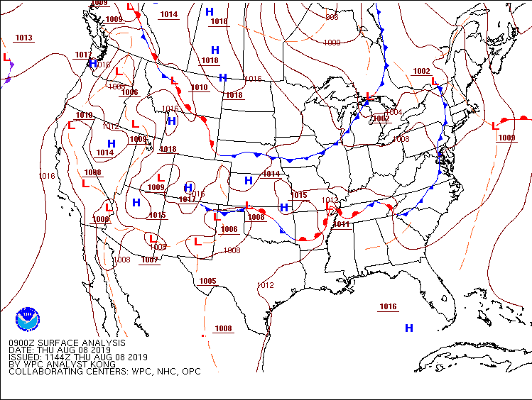
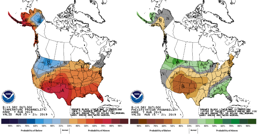
Good morning and happy Friday-Eve. We have had patchy fog around the region for much of the morning. Luckily, that is beginning to lift and fade out leaving behind partly sunny skies and warm conditions again today. The latest surface analysis shows a familiar pattern with a cold front drapped to our north. Just like earlier this week, this cold front will move through tomorrow bringing showers and thunderstorms. Models suggest the timing to be later in the day and into the overnight hours Friday. Looking ahead, scattered showers and storms will roll through late Friday leaving behind some residual showers and storms for your Saturday. As we continue through the day Saturday, a high pressure system (to the north) will move in giving us a warm and dry end to the weekend. The model below is our short term "high resolution" model. As similar models are in sync, it suggests scattered showers and storms begin to move through later tomorrow afternoon and into the overnight hours. I am not anticipating much on the severe side, but some rounds of storms can be stronger at times. Models continue to suggest the bulk of activity will be in middle Tennessee and to our friends to the south and west. Looking long term, the CPC released their latest predictions on temperatures and precipitation over the next couple of weeks. Data is suggesting we will continue staying warm with near average to slightly above average temperatures. For precipitation, we will be near average to slightly below average over the next couple of weeks.
0 Comments
Leave a Reply. |
Your trusted source for everything weather in East Tennessee.
Social Media
|


