|
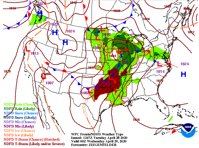
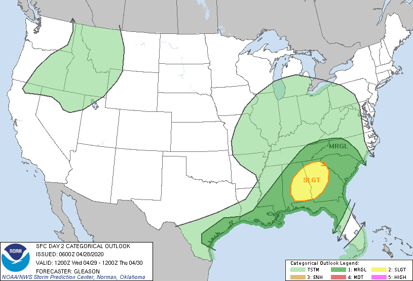
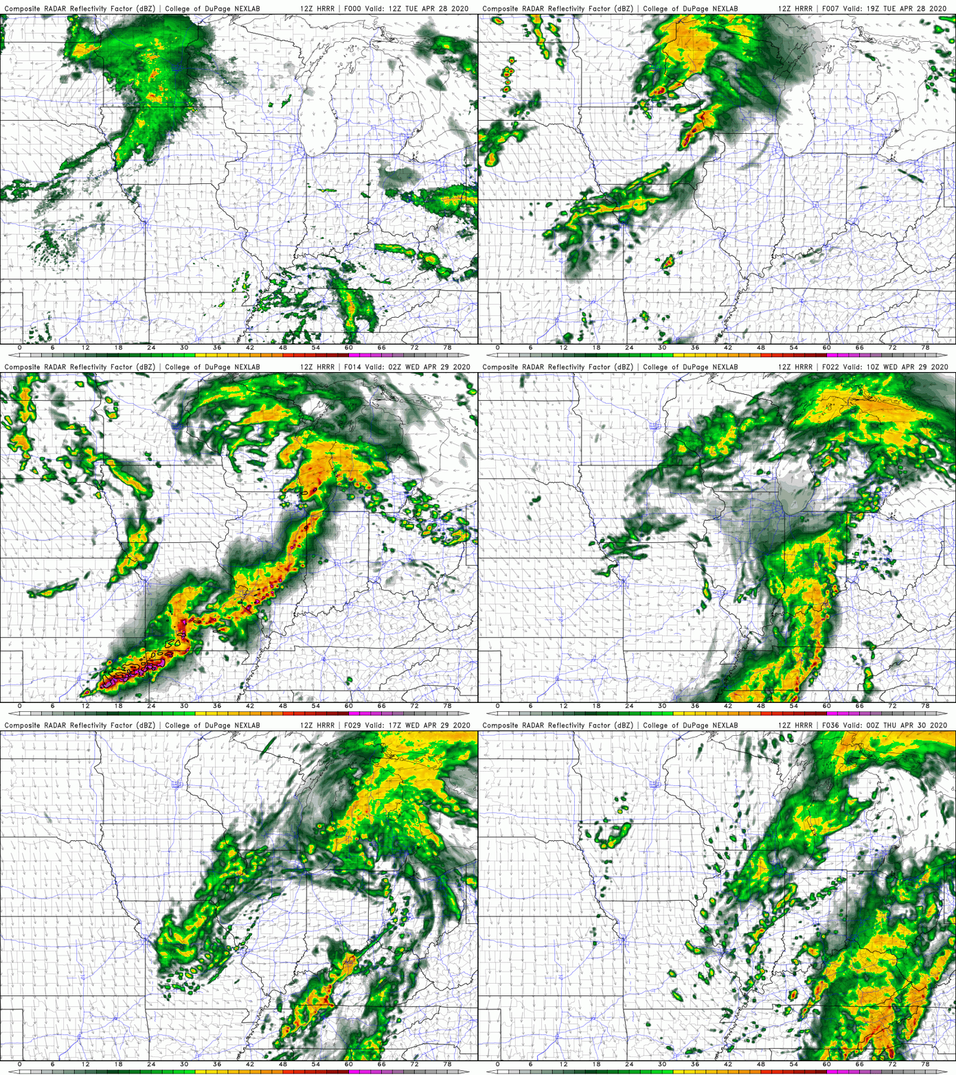
A mix of sunshine and cloud cover will dominate the day as high's will climb into the mid 70's. Wednesday's forecast is a bit different though as showers and thunderstorms are expected. Looking first at today's surface map (left), severe storms are likely throughout parts of Oklahoma, Texas, Arkansas, and Missouri this afternoon. As they slide east ahead of the cold front, they will begin dying out overnight. Jumping to the SPC outlook (right) a slight risk is in place for northern Georgia and parts of Alabama. The main line of showers will start our day Wednesday bringing the chance for moderate rainfall. The threat we will be eyeing comes in the afternoon and evening hours tomorrow. As you can see, parts of Arkansas and Oklahoma will see very strong storms this afternoon and evening before that line of storms weakens overnight. It will arrive to our neck of the woods by the morning hours bringing moderate showers (non-severe) to the area. As daytime heating persists tomorrow, we could see stronger showers develop in the afternoon. I wouldn't be surprised to see the SPC extend the 'slight' risk a bit further north (into TN) as the chance for strong to severe storms is possible. We will continue to monitor this but be aware that gusty winds and hail are possible tomorrow afternoon & evening. That wraps it up for today...have a good Tuesday and stay dry for Wednesday. For more information on how Secret City Weather can help you and your business, contact us at [email protected] or visit our "services" tab.
0 Comments
Leave a Reply. |
Your trusted source for everything weather in East Tennessee.
Social Media
|


