|
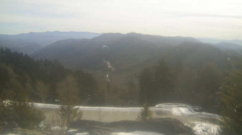
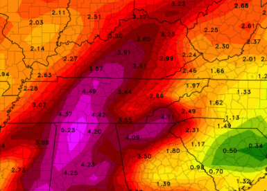
After a chilly weekend with some snowfall for the higher terrain, Newfound Gap still has 9+ inches of snow depth. Mt. Leconte recorded a 20" snow depth Saturday, as nearly a foot fell. Closer to home, conditions are pleasant region wide. High pressure remains in control, setting up pleasant temperatures and most sunny skies. We will continue to warm up into Tuesday, with highs near 60 (yes that's correct) for some! This will be short lived though, as a flooding threat and the return for cold air arrives the second half of the week. Breaking down modeled guidance, a warm front will build north tomorrow increasing moisture across the area. As such, rain will arrive Wednesday and continue on and off (with periods of breaks) through the day/night. A cold front will then take aim Thursday, bringing heavy rainfall and the chance for all precipitation types. As cold air overrides warm air, a change over to some freezing rain, sleet, and snow is possible. Fortunately for us, the bulk of this threat will be to our north and west. The arrival of cold air looks to be slower, resulting in mainly a rain to brief change over event. Even so, the potential for impacts will be possible. This will be particularly so with flash flooding/flooding, but slick roads (especially for the higher terrain) is possible Friday morning. Looking at rainfall totals Wednesday through Saturday, upwards of 5 inches can't be ruled out across middle and western TN. There still remains lots of uncertainty in the track of this system, but rainfall is expected. Across East Tennessee, 2-3+ inches, with locally higher amounts is likely. This could lead to rising high waters and flash flooding. I anticipate the WPC to issue flash flooding risks in the days ahead, as well as a shot at flood watches for some. Depending on the track we could see higher rainfall amounts or even lower, but time will tell. For now, be aware of the potential and check back in for updates on any changes. Cold air will finish out the work week, with highs Friday in the 30s to low 40s. Sunshine will make a return this weekend after all the rain expected Wednesday through early Friday morning. Pre-recorded for 5pm show
0 Comments
Leave a Reply. |
Your trusted source for everything weather in East Tennessee.
Social Media
|


