|
We'll end today and Friday on a quiet note with a mix of clouds and lots of sunshine. Temperatures will remain warm with high's in the mid to upper 80's this weekend. 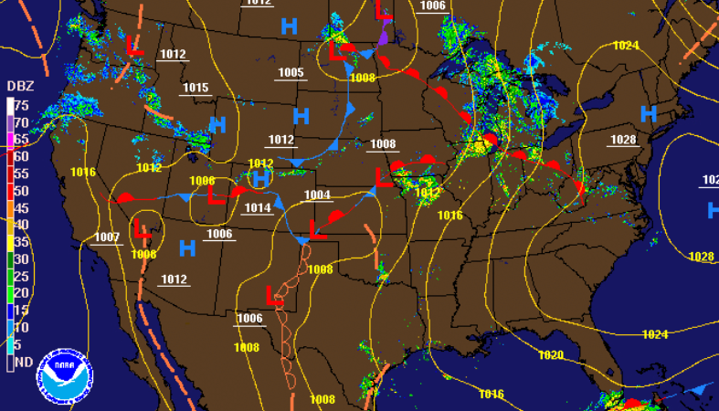 The outlook for Friday will remain very similar to today with high's in the low to mid 80's (for the southern region). Sunshine will also return with a mix of cloud cover working through in the afternoon. Though temps will be above average, dew points will remain in the 50's Friday. This will make things feel a bit closer to the true temperature rather than sticky and hot. 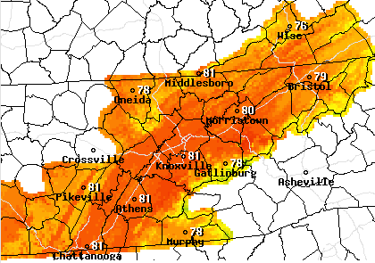 Outlining the weekend ahead, model guidance continues to suggest rainfall into Saturday and Sunday. This will depend how close the low pressure system gets and how much moisture will still be associated with it. A majority of this activity (Saturday) will stay to the higher elevations will day time heating and orographic lift being the main contributor. Nonetheless, I am not expecting a ton of shower/t'storm activity with isolated afternoon showers being the likely outcome. This will continue into Sunday as the low draws closer. Shower and a few storms will likely be a bit more widespread Sunday afternoon and overnight. Cooler air will slide through on Monday with scattered showers possible. High's in the lower 70's and sunshine will return for Tuesday and mid-week. 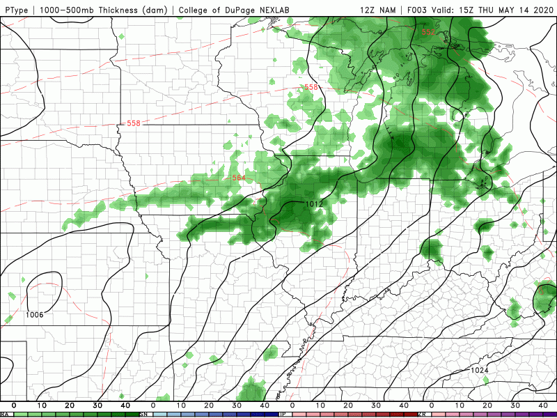 That will wrap it up for today but I wish everyone a wonderful Thursday.
0 Comments
If you have followed along the past week, we mentioned the likelihood of an above average hurricane season. Looking below, we are already seeing an active Atlantic. Coming out of the National Hurricane Center, there's a high likelihood this area of low pressure (north of the Bahamas) will develop into a subtropical depression or storm in the next few days. Not to worry though the path will continue north and east with no impacts expected for the US. 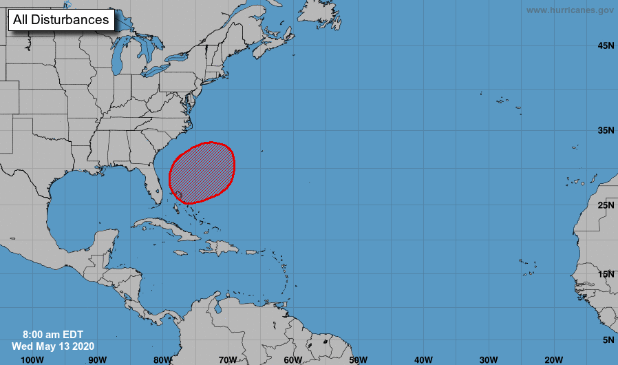 Jumping back to home, shower activity has been limited to the Plateau and southern Valley so far today. As we push into the afternoon hours, I expect this to continue before skies begin clearing overnight. A warm front is also working through the area today, providing much warmer air from the south tomorrow and the days ahead. 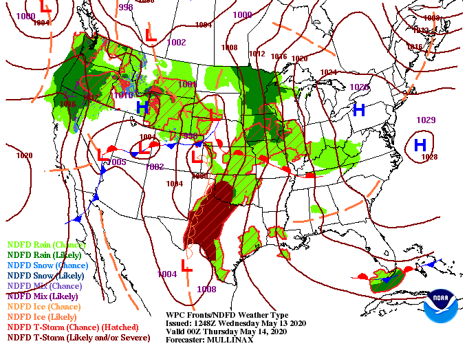 To highlight the month of May so far, we have had 4 record low temperatures. Two of these were tied for the record low and two were new record low temperatures altogether. An opposite effect will take place the later half of May with above average temperatures working in. High's near 90 degrees will be possible this weekend, especially for those to the south. 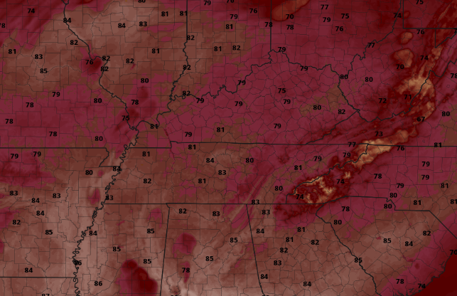 Sunshine will dominate the next few days before shower activity creeps back in in limited quantities this weekend. Have a good one and brace for warm temperatures the next several days. I hope you are enjoying your Tuesday so far. It has been rather uneventful with broken cloud cover overhead. As we work further into this afternoon, a better shot of sunshine will become evident. Don't get too excited though, cloud cover moves back in tonight with scattered showers possible Wednesday. 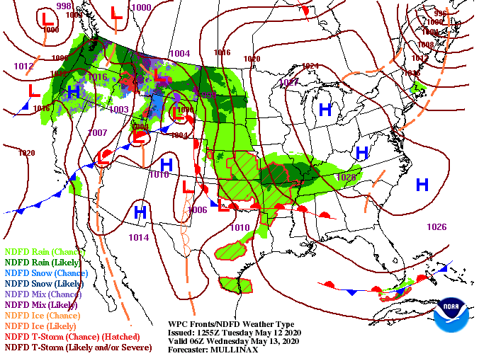 The bulk of rainfall will stay north and west but isolated to scattered showers are possible overnight and into Wednesday. For the days ahead, sunshine will find its way back Thursday and the remainder of the week with warm temperatures to accompany. Though most of us will stay dry Thursday and into the start of the weekend, isolated afternoon pop up showers/ storms are possible.  Thursday will be the "game changer" day as a warm front lifts north. Warm southern air will begin flowing across the region raising high's into the 80's. This looks to continue for the foreseeable future, so prepare for above average temperatures the next several days. Average high's this time of the year sit in the upper 70's for Oak Ridge and Knoxville (77/78). 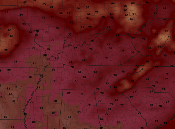 Longer term impacts look to be a warm summer with an active Atlantic, so we will be watching this over the next several weeks & months. For now, enjoy the warmer temperatures in the days ahead. I hope the new work week has treated you fair so far. Looking into the weather this week, changes are on the way. Just to the west you can see a system that'll bring a chance for scattered showers mid-week before warmer air moves in behind a warm front. 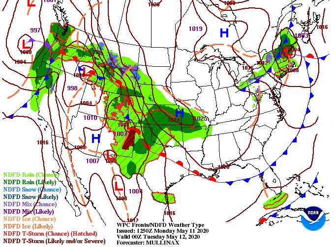 As depicted by the QPF (Quantitative Precipitable Forecast), this next rain maker will stay mainly to the north. With limited activity expected Tuesday night and Wednesday, around a tenth of an inch of rainfall is possible before sunnier skies return. 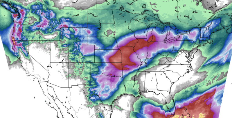 Getting into the main headline this week, much warmer air will make a return. We'll see high's this afternoon and Tuesday in the low to mid 60's with high's in the low to mid 80's by Thursday and Friday. Looking longer term, expect this to continue as a pattern shift is beginning to occur across the country. This means average to above average temperatures will likely stick around for the foreseeable future.  If you would like more information on how Secret City Weather can help you or your business, email us at SecretCityWx@aol.com or visit our services tab above. That will do it for today but I hope everyone closes out Monday on a strong note! Showers continue across the valley at the lunch time hour with more coming later this afternoon. The good news is once this system passes, lots of sunshine will be around the next several days. On the flip side, things will be quite cold the first half of the weekend.  A cold front is tailing the rain we are seeing right now and that will contribute to overnight low's in the lower 30's. Frost and freezing temperatures are a major concern for the AG belt so take the proper precautions. For this weekend and next week, a high pressure system will dominate the eastern half of the US providing lots of sunshine and warming temperatures. 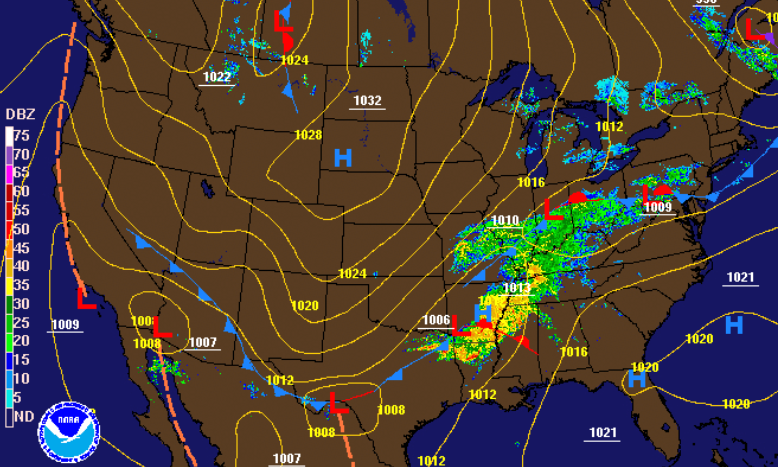 As showers move out this evening, light snowfall is probable in the highest peaks of the Smokies. We'll see lots of sunshine this weekend and early next week before showers return towards the middle of next week. 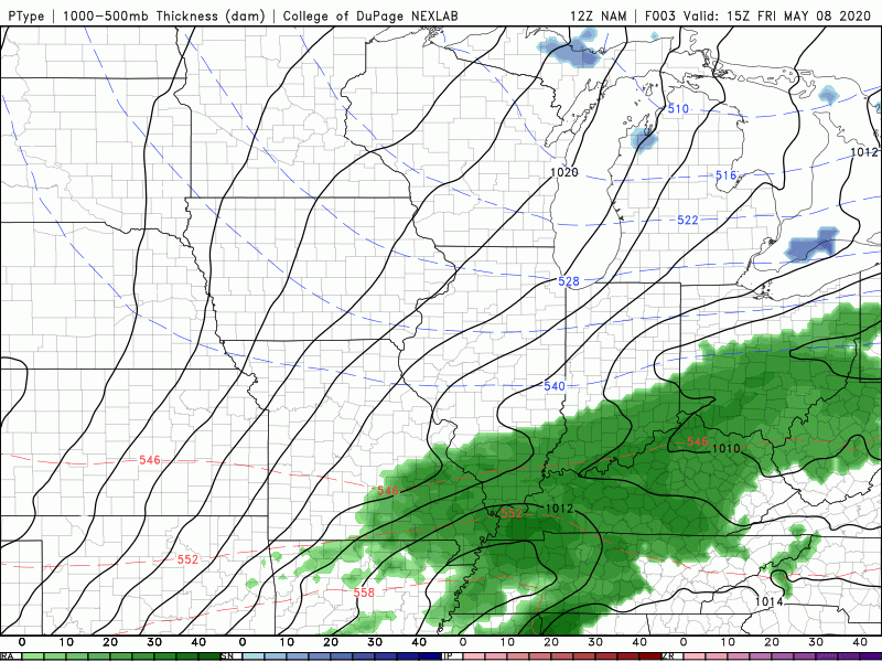 Tomorrow morning will be very cold with "feel-like" temps in the 20's and low 30's for most (more details in the video below). That does it for today but I want to wish all the Mother's out there a happy early Mother's Day! It'll be a beautiful weekend to celebrate mom and spend time with family. Wow! How about this view from Clingman's Dome to start the day. Things may be sunny and comfortable here at home but a few thousand feet above us temperatures are in the lower 30's and light snowfall can still be seen on the tree tops. Another round of wintry precipitation is likely early into the weekend for the peaks of the Smokies. 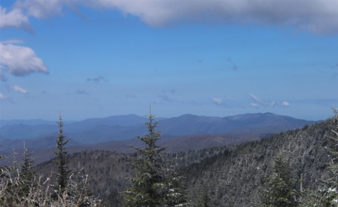 As for the valley, sunshine and comfortable temperatures will stick around today. Don't anticipate this to last long though, as more rainfall and cold air works in tomorrow.  Showers will begin working in by the morning hours and will continue on and off into the afternoon. Behind this system is a cold front that will leave things, quite literally, freezing cold Friday night and Saturday morning. Sunshine will return for the weekend and early next week and temperatures will start to rebuild as well.  Taking a deeper dive into the overnight low's Friday, model guidance is suggesting mid 30's here in the valley. I think guidance is trending a bit warm for low temperatures and here's why: Cloud cover is very important in forecast overnight low's. Clouds act like a blanket keeping warmer air in during the overnight hours. If this system works out by the evening and early overnight hours, the valley will likely see low's around the freezing (32) mark. This will leave low's in the upper 20's for those in the Plateau, northern Valley, and Foothills. Be sure to cover all important plants/crops Friday night and Saturday night. Frost and freezing temperatures will be a major concern this weekend. 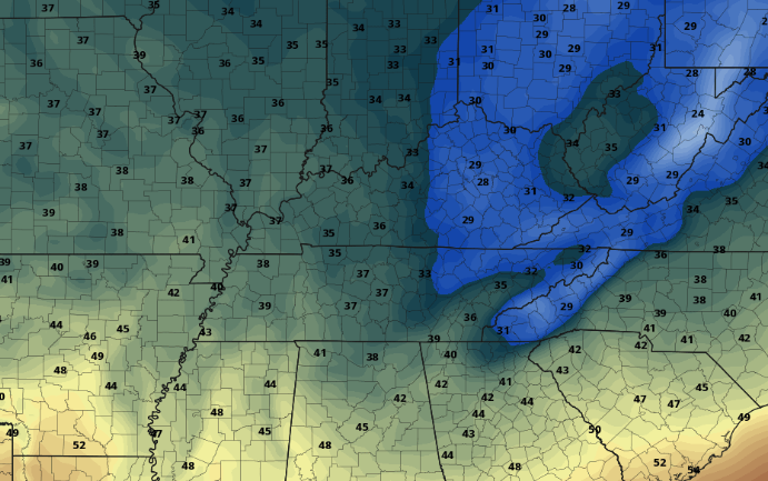 Enjoy today as temperatures will be fairly comfortable and sunshine will stick around overhead. Another round of rainfall and cold air will arrive tomorrow before temperatures rebound Sunday. Brr! The latest cold front has driven temperatures 10 to 15 degrees cooler this afternoon with little change coming in the days ahead. High's this afternoon will hang around 60 degrees with overnight low's, for most, in the 30's. The average temperatures for this time of the year are in the mid 70's during the day and lower 50's overnight. 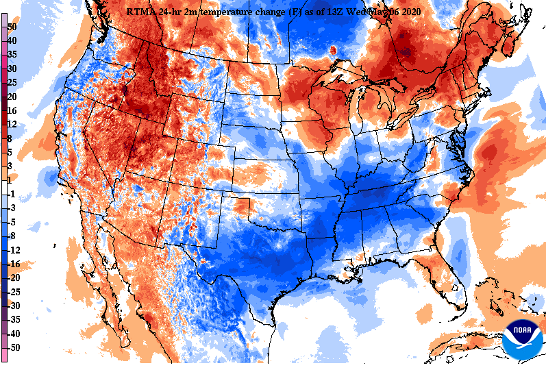 We do have some better news for Thursday with sunny skies and warmer temperatures. Enjoy tomorrow while you can though, rain and cooler air return Friday. For those planning ahead, this weekend will be beautiful with sunny skies both days. Temperatures will remain on the cool side with high's around 60 Saturday and mid to upper 60's on Sunday. 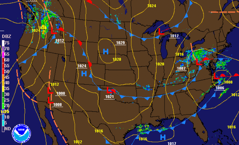 For the remainder of this afternoon, a few isolated showers will continue before clearing takes place this evening and overnight. Thursday will be dry and sunny with showers and a few storms returning Friday. Again, a cold front will cool things down as we enter the weekend before temperatures gradually warm Sunday and early next week.  If you have outdoor plants, be sure to cover them over the next few nights. We outlined the forecasted temperatures (below) the next few nights and how that stacks up to the low temperature records. If Secret City Weather can help you, send us an email at SecretCityWx@aol.com or visit our services tab at the top of the page. A warm front is moving through the region today, contributing to the 70's we are already seeing early this afternoon. Changes are on the way though as a cold front will then shift through overnight tonight. As the cold front works in, showers and storms are possible out ahead of it this afternoon. The bulk of showers and storm potential will stay east the later half of the day. If they do develop a bit sooner and further west, gusty winds and small hail will be the main concerns. 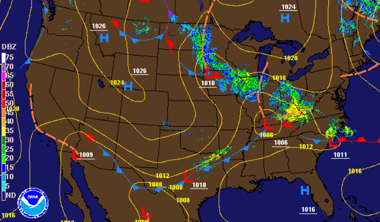 Looking into Wednesday, limited moisture potential will be present mid-morning to early afternoon before clearing takes place Wednesday evening. With that said, shower activity will be light and scattered the first half of the day tomorrow before sunny skies return Thursday. Another system arrives for Friday bringing showers and a few storms before a second cold front sweeps through. The weekend looks beautiful with sunny skies and high's in the 60's. 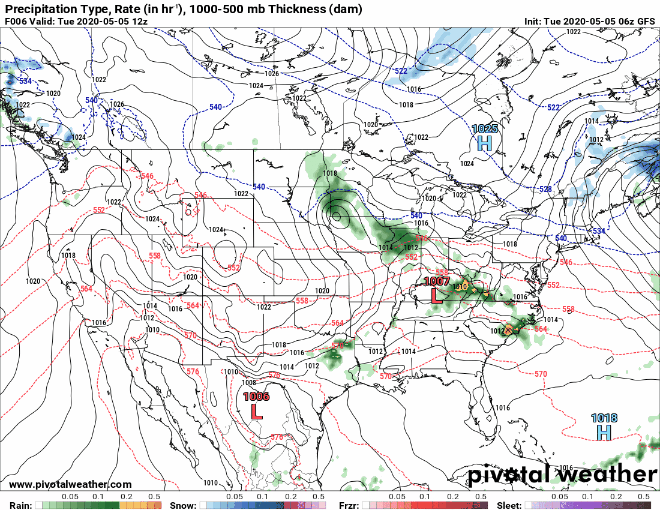 The main concern ahead will be overnight temperatures. With the first cold front moving in overnight tonight and through Wednesday, Thursday morning temperatures will be in the upper 30's to lower 40's across the region. Frost potential will be limited this first round but the same can't be said for the second round. Friday night low's (for the valley) will likely be in the upper 30's to lower 40's with Saturday night low's likely in the mid 30's. Keep in mind cloud cover and ground moisture will play a large roll in surface temperatures so things can change for the better or worse. Elevation will also play a roll with cooler temperatures likely for those in the foothills and plateau. As of now, those of you in the agricultural sector or have important outdoor plants, Friday night and Saturday night have the potential for frost and/or freezing temperatures. If you'd like more information on the temperatures in the days ahead and how that could play a roll in crops/outdoor plants, send us an email at SecretCityWx@aol.com or visit our services tab above. 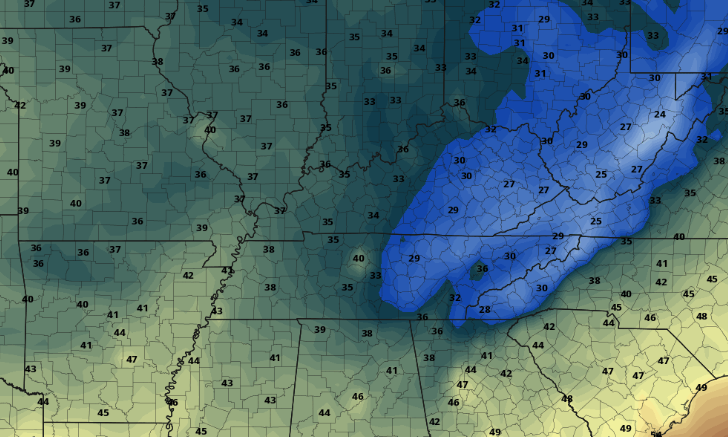 If showers and storms do begin developing across the area this afternoon we'll be sure to let you know! Stay safe and stay warm as high's tomorrow will be in the 50's and lower 60's across the region. To all the Star Wars fans out there, May the 4th be with you today. For everyone else, may the sunshine return...at least for this afternoon. Shower activity will find its way back late overnight tonight and into the day tomorrow. 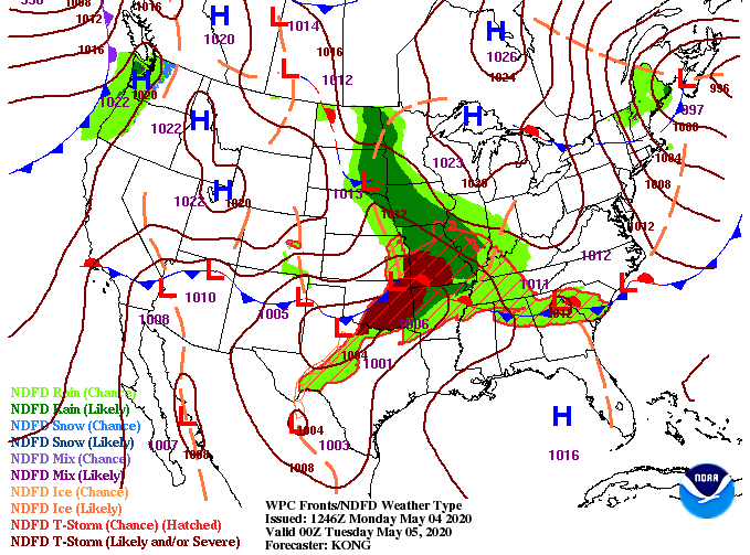 Looking ahead, scattered showers will arrive late overnight and early into Tuesday morning. The SPC outlines a 'Marginal' risk for parts of eastern TN (Knoxville & east) but I expect the majority of heavier "stuff" to stay a bit further north. We will watch to see if the SPC changes their outlook to match that or continue with what they have. Regardless, be weary of gustier winds at times tomorrow as that will be the main threat. Keep in mind, as well, we aren't looking to have an all day consistent rain event but instead on and off showers through the day. Sunshine and cooler temperatures are expected for Wednesday and Thursday.  As mentioned, the later half of the week is when we can anticipate a cold snap for the eastern US. Overnight low's will be in the 40's with the coldest night being Friday. Two set's of cold fronts this week will allow for low's Friday night into the 30's. This is important to those of you in the agricultural sector as frost and freezing temperatures can pose a threat to crops. If you'd like more information on temperatures this week, long term outlooks, or weather forecasts specific to farm operations, send us an email at SecretCityWx@aol.com or visit our 'Services' tab (found above). 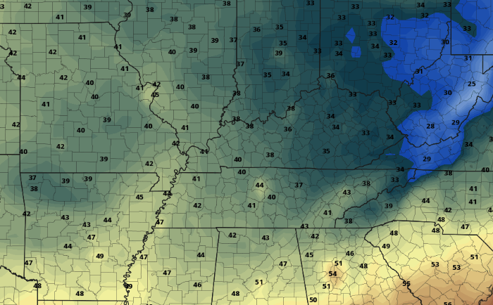 That will wrap it up for today but find the umbrellas and light jackets for the days ahead. A beautiful afternoon is ahead with this view from the Newfound Gap cam in the Smokies. If you are wanting to get outside and enjoy the warming temperatures and sunny skies, this is the time to do it. We'll continue to warm into Saturday and Sunday before showers find their way back in Sunday night. 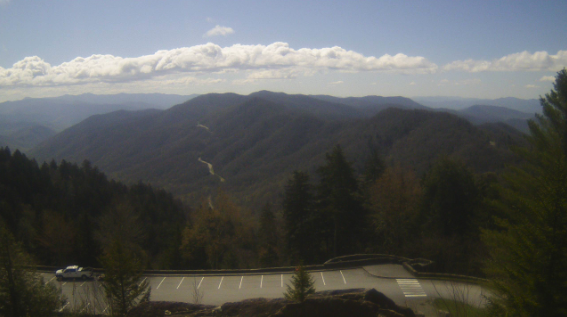 Little action is expected the next couple of days as winds will shift out of the south and temperatures warm into the 70's and 80's this weekend. As usual though, all good things must come to an end. Shower activity will move back in Sunday night and into the early portions of next week. 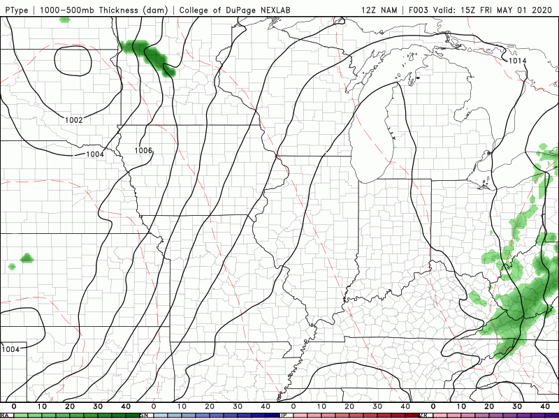 Taking a look into Sunday afternoon, expect to see high's in the lower 80's here in the valley. The average for this time of the year is in the mid 70's, so we'll be 5-7 degrees above that to close out the weekend. Cooler air, back in the 70's, will return for Monday and Tuesday. 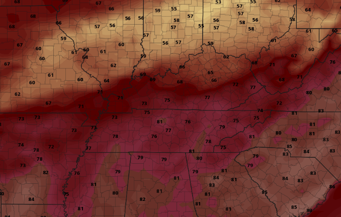 That will conclude today's forecast but be sure to check out our full forecast below and I hope everyone has a great weekend! Be sure to share your outdoor adventures with us by sending pictures to SecretCityWx@aol.com or tagging us on Twitter/Facebook @SecretCityWx |