|
A warm front is moving through the region today, contributing to the 70's we are already seeing early this afternoon. Changes are on the way though as a cold front will then shift through overnight tonight. As the cold front works in, showers and storms are possible out ahead of it this afternoon. The bulk of showers and storm potential will stay east the later half of the day. If they do develop a bit sooner and further west, gusty winds and small hail will be the main concerns. 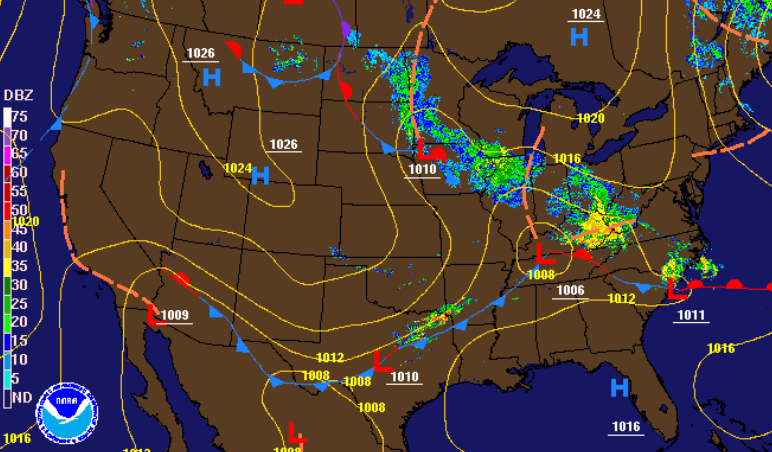 Looking into Wednesday, limited moisture potential will be present mid-morning to early afternoon before clearing takes place Wednesday evening. With that said, shower activity will be light and scattered the first half of the day tomorrow before sunny skies return Thursday. Another system arrives for Friday bringing showers and a few storms before a second cold front sweeps through. The weekend looks beautiful with sunny skies and high's in the 60's. 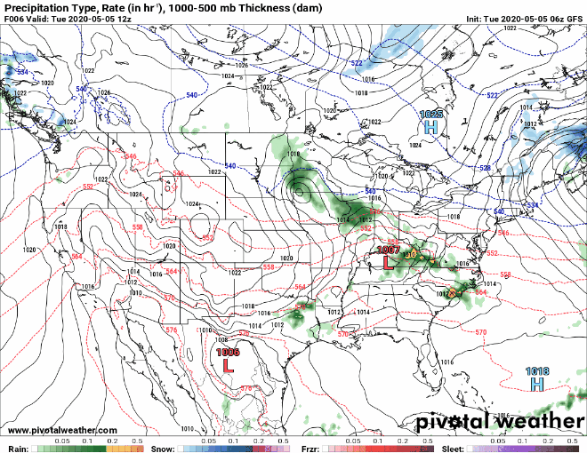 The main concern ahead will be overnight temperatures. With the first cold front moving in overnight tonight and through Wednesday, Thursday morning temperatures will be in the upper 30's to lower 40's across the region. Frost potential will be limited this first round but the same can't be said for the second round. Friday night low's (for the valley) will likely be in the upper 30's to lower 40's with Saturday night low's likely in the mid 30's. Keep in mind cloud cover and ground moisture will play a large roll in surface temperatures so things can change for the better or worse. Elevation will also play a roll with cooler temperatures likely for those in the foothills and plateau. As of now, those of you in the agricultural sector or have important outdoor plants, Friday night and Saturday night have the potential for frost and/or freezing temperatures. If you'd like more information on the temperatures in the days ahead and how that could play a roll in crops/outdoor plants, send us an email at [email protected] or visit our services tab above. 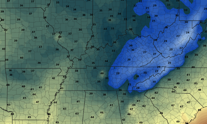 If showers and storms do begin developing across the area this afternoon we'll be sure to let you know! Stay safe and stay warm as high's tomorrow will be in the 50's and lower 60's across the region.
0 Comments
Leave a Reply. |