|
Good morning to you! If you haven't left the house yet, be sure to throw on a coat. As you can see below, current temperatures are in the upper 40's and lower 50's across the valley. Fortunately, we will warm up to another beautiful day in the mid 70's with plenty of sunshine. 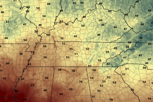 Looking at the latest surface map, a high pressure system is positioned in New England keeping things sunny and comfortable again today and tomorrow. Longer term, another tropical system will bring precipitation chances across the region. As indicated by the name, the National Hurricane Center has run out of hurricane names for the 2020 season. This is only the SECOND time in history this has ever happened. As Beta works north and east, moisture will accompany and begin arriving by Thursday. A low in behind will also provide rain chances through the weekend. 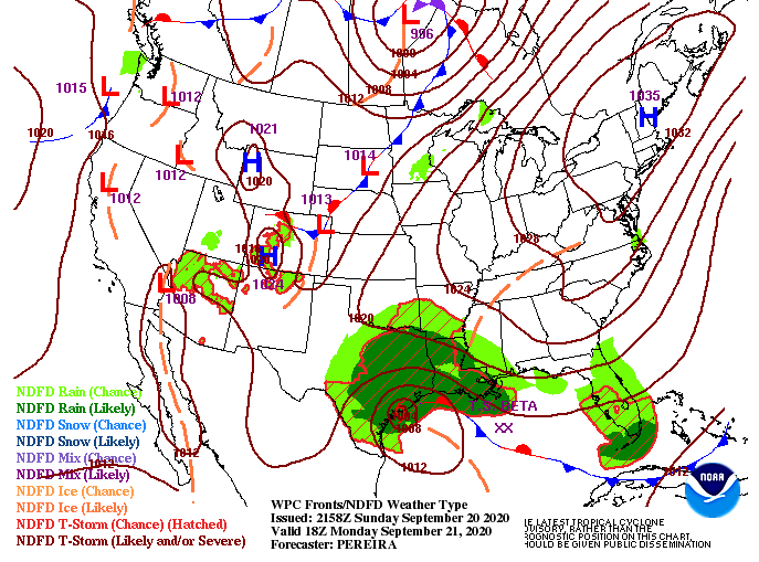 As you would expect, things will be peaceful the first half of the work week. As we work into Wednesday, winds shift to out of the south, pushing in moisture and warmer temperatures. By Thursday, shower chances are back in the forecast. Given the latest model data, scattered showers are possible Thursday through the weekend under broken to cloudy skies. High's will gradually increase as well, back to the 80's on Friday and Saturday.  Overall, enjoy the first half of this work week before a more dreary pattern presents itself later in the week. High's will also increase but stay at to slightly above average for this time of the year. If you enjoyed some outdoor time: hiking, the lake, camping, etc. don't forget to share with us! Send you pictures to [email protected] or by tagging us on social media (Twitter &/or Facebook).
0 Comments
Leave a Reply. |