|
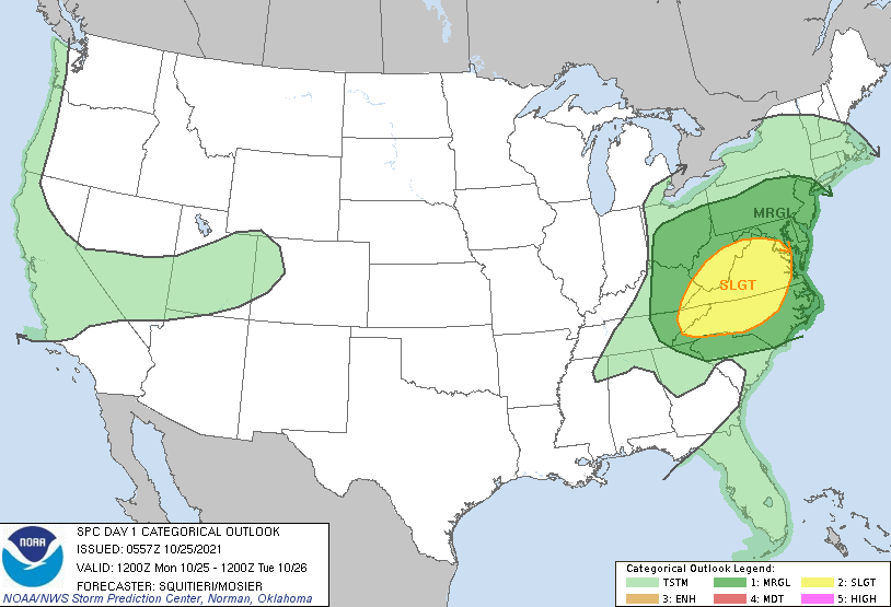
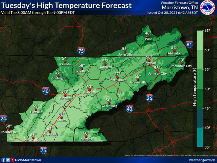
Good morning! I hope you have your umbrellas handy...a line of showers is currently working across Middle Tennessee and will arrive over the next hour or so. With it will be moderate showers along with a few embedded thunderstorms. Severe potential is low today, but strong to damaging wind gusts aren't to be ruled out. The SPC has issued a slight chance for far northeast Tennessee to include the opportunity for brief spin-ups as well (this afternoon/evening). Breaking it down, a line of showers/storms will work through this morning, with gradually clearing skies tonight and into Tuesday. Temperatures will fall tomorrow, before rebounding Wednesday to near average. Another system will then arrive, as a low makes its way out of the southwest and crosses just to our north. This will bring consistent rainfall Thursday, parts of Friday, and eventually moving out on Saturday. Rainfall totals look to be anywhere between 1 and 1.5 inches from now until Sunday. With cooler air working in this evening and Tuesday, highs will take a dip. Highs according to the NWS will range from the mid 50s (higher elevations) to near 60 for valley locations. These will continue to increase for Wednesday, with highs in the mid and upper 60s area-wide. Have a way to receive alerts if any warnings are to be issued. The severe threat appears to be very low and limited to the far northeast and into the Virginias. This will be best this afternoon as a second round of showers/storms develops across Middle KY and could catch the far NE. Pre-recorded for 5pm show
0 Comments
Leave a Reply. |
Your trusted source for everything weather in East Tennessee.
Social Media
|


