|
Good Wednesday morning to you! Temperatures start cool as cloud cover cleared out overnight. As we work through the day, much needed sunshine and comfortable temperatures are on tap. High's today and Thursday will be above average in the low to mid 60's. The graphic below depicts the temperatures anomalies. As you can see, high's will average nearly 10 degrees above the norm this afternoon & Thursday. 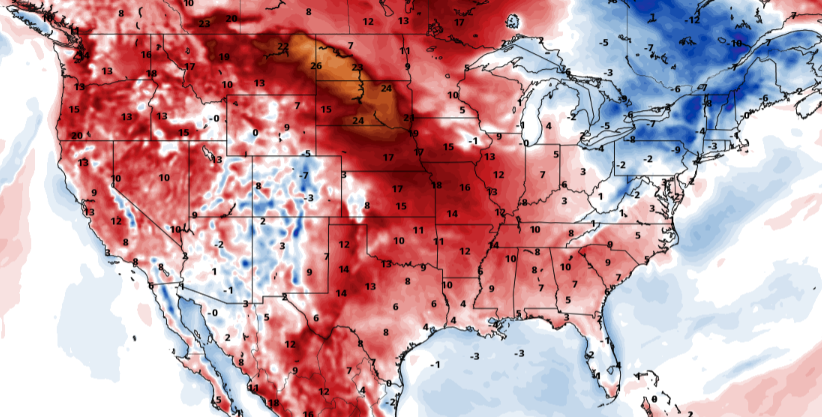 The weather pattern the remainder of the week should be a fairly quite one. High pressure will work through the southeast leaving sunshine and comfortable temperatures today and tomorrow. A cold front will work through Thursday knocking temperatures closer to average but we should stay rain free. Overall, this is the weekend to make some outdoor plans or get out for a walk through the neighborhood; conditions look great!  A long stretch of sunshine and average to above average temperatures will be in the forecast now through the weekend. Go out and enjoy the beautiful conditions we have ahead. Also be on the look out for our Almanac....we'll have that out very soon :) Pre-recorded for 5pm show
0 Comments
We have started cool this morning thanks to the cold air that has advected in yesterday afternoon and overnight. Looking below, temperatures are 20 degrees + cooler than this time yesterday. This is all relative, of course, as high's Sunday topped out in the mid 70's and morning temperatures Monday were in the 50's. For this afternoon, anticipate high's on average, in the low to mid 50's. Breaks in the cloud cover will provide sunshine at times during the day.  A system to our south has developed and will work east through the day today. Cloud cover should stay pretty locked in for a majority of the day but a few breaks will allow for sunshine at times. As we creep into the overnight hours, a light rain will be possible for mainly the southern half of the state. By the early morning hours Wednesday, showers should be out and cloud cover will be on its way too. Lots of sunshine will follow with high's the second half of the week near average in the mid to upper 50's.  We have made it through the heavy rains and can enjoy some much needed Spring-like weather the second half of the week and into the weekend. Get out and enjoy the fabulous conditions expected ahead! Pre-recorded for 5pm show
We start the new work week soaked with showers continuing to work through this morning. Fortunately, this is the last wave before a brief stent of drier air finds us this afternoon and into Tuesday. As a cold front pushes through this morning, temperatures will drop through the day. High temperatures are actually occurring now with temps this afternoon to be around 50 degrees.  As rainfall continues to evacuate eastward, flooding continues to be a worry. Water run-off will continue through the day contributing to any flooding that is still going on, especially for bordering counties with Kentucky. In the days ahead, an unsettled pattern continues. A system developing off the panhandle of Texas will lift north and east, bringing rainfall Tuesday night into Wednesday. 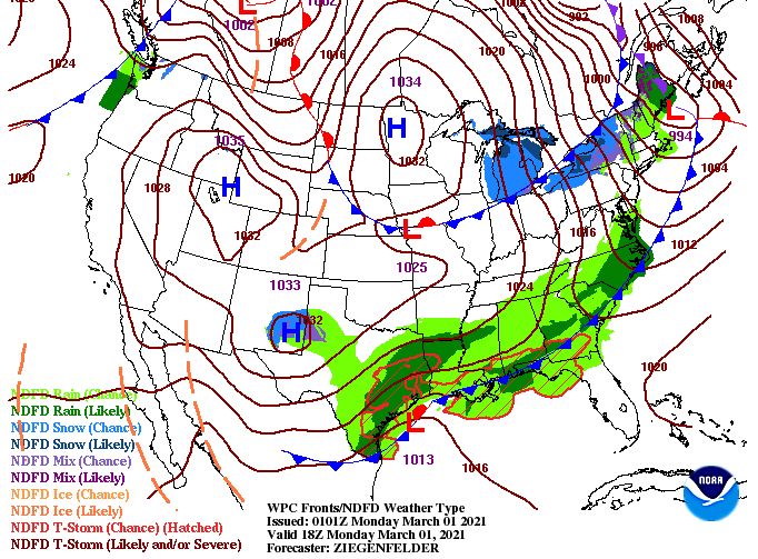 Looking at a play-by-play of what you could see, showers are expected to arrive while many are asleep Tuesday night and move out by the lunch time hours Wednesday. Following, much better weather is in store. Sunny skies and average temperatures will find us the later half of the week, something much needed region-wide given the plethora of rain Tennessee and Kentucky has received. 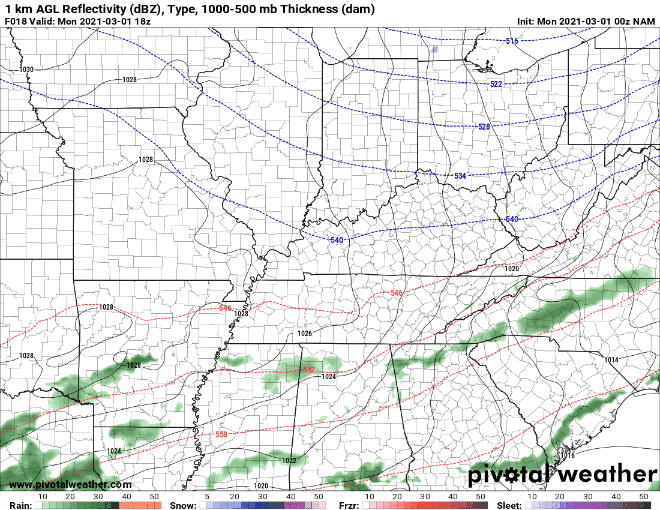 Do your best to stay dry this morning....showers will continue to push east with drier air in store by this afternoon. We deal with another system midweek before sunny and comfortable temperatures find us late in the work week and into the weekend. Pre-recorded for 5pm show
|