|
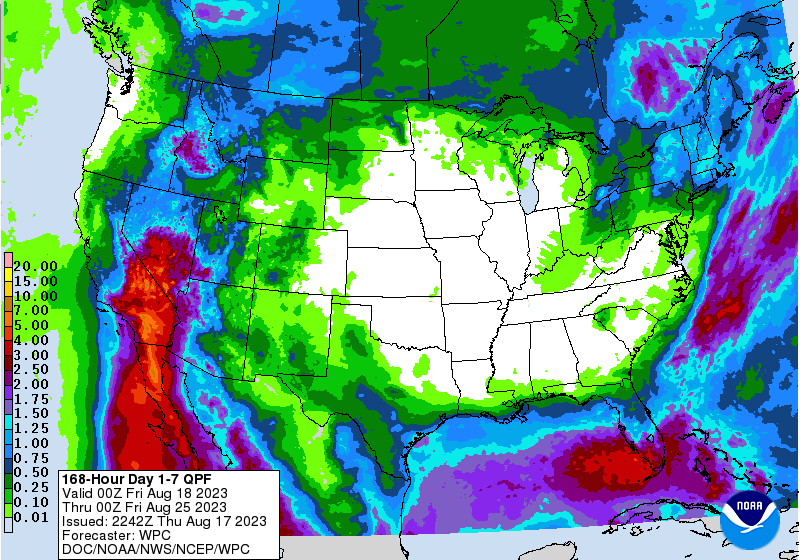
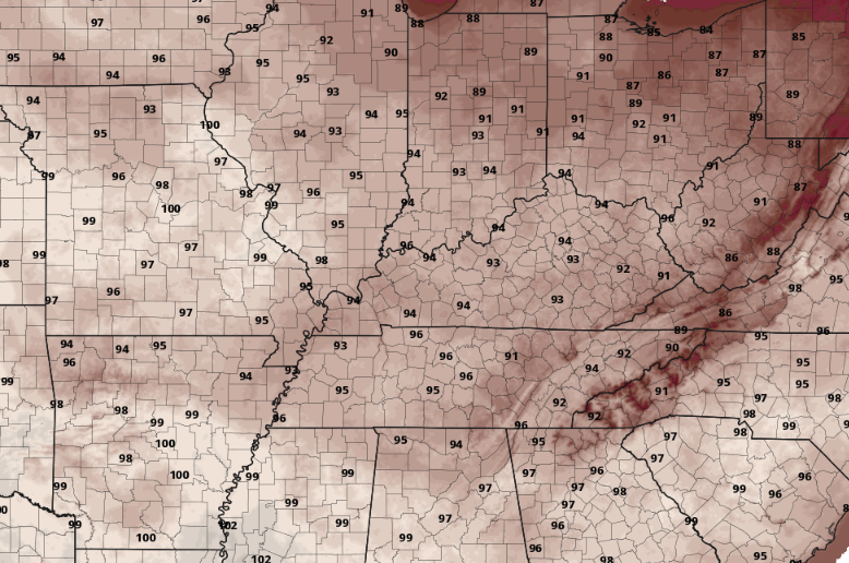
I hope your Friday is off to a good start! The forecast for today should bring you good news, as many top out in the low to mid 80s under mostly sunny skies. The trend moving forward is that of a dry and hot one. Looking below, this is the 7-day rainfall outlook (according to WPC) for the United States. As you can see, no meaningful rainfall is expected today through next Thursday, and this will be the case for much of the center of the U.S. So what kind of influence will this strong high pressure bring to East Tennessee? A late summer heatwave. Temperatures will feel wonderful today, but changes are quickly on the way. By Sunday, highs will range in the upper 80s to low 90s, followed by increasing values thereafter. Potential highs, visualized below, could warm into the low and mid 90s by Tuesday, with a few mid to upper 90s not impossible Wednesday and Thursday (especially for southern locations). To make matters worse, humidity will make things feel closer to the triple digits for many. Something we have fortunately not had to talk much about this year is the heat, but keep your heat safety in mind all of next week as this will likely be the warmest we have been this year to date. That will do it for today...get out and enjoy the beautiful weather planned through this evening. We will even start Saturday morning off with a fall-like feel with lows tonight in the upper 50s to near 60 degrees. A heatwave then sets up Sunday into next week.
0 Comments
Leave a Reply. |
Your trusted source for everything weather in East Tennessee.
Social Media
|


