|
Over the past couple of months, gradual improvement has been seen across the western half of the state. The same can again be said this week as well, with only slight indications of dry conditions across mainly the southwest. Moving forward, we could see this revert back to increasing dry conditions given the lack of rainfall forecast over the next week or so. 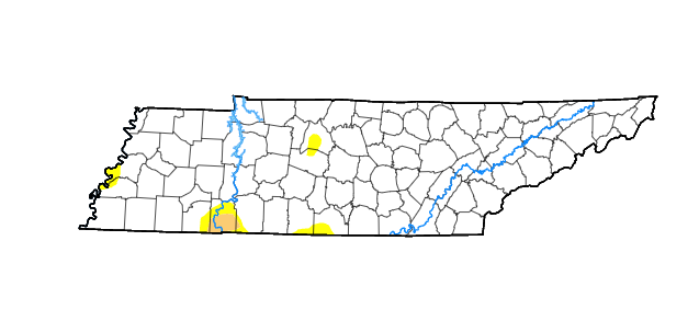 Moving to the Tropics, Tropical Storm Fiona has spun up. She is expected to shift west with time, crossing into Puerto Rico late Saturday, and then finding the Dominican Sunday, before shifting eastward. There is some indication this will ride along the east coast next week, but time will paint the better picture. For now, no direct threat to the USA, but the Caribbean will see heavy rain, gusty winds, and storm surge through the weekend. 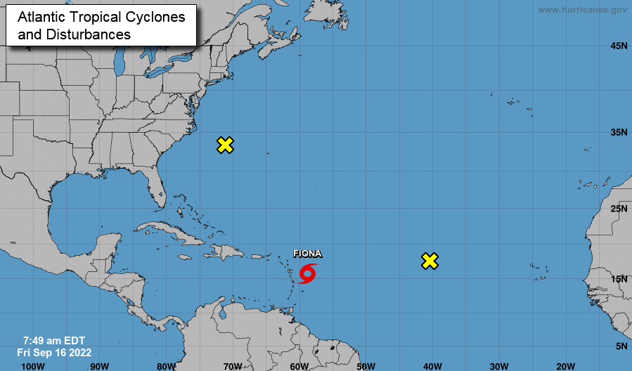 In terms of the local forecast, high pressure and upper level ridging remains in place through the next several days. As a result, temperatures will soar back to the typical Summer time heat we have (but haven't) been missing. Highs will find the 90s by mid week (this next week), with temperatures across the Central Plains 20+ degrees above the typical average. This will also suppress any shower potential through at least early next week, with guidance suggesting little to no rainfall for the whole week possible. For now, enjoy the fair temperatures before things continue to warm this weekend and into next week. 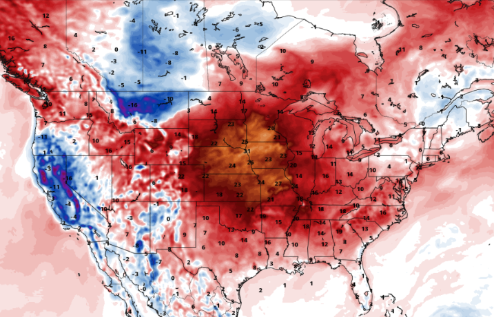 Highs will generally average the mid to near upper 80s Saturday and Sunday, with mostly sunny skies. Afternoon cumulus will be common most days, dissipating into the night. I hope everyone has a wonderful weekend! Send us a few shots if you head out, which can be sent via email [email protected] or through Twitter or Facebook @SecretCityWx
0 Comments
Leave a Reply. |