|
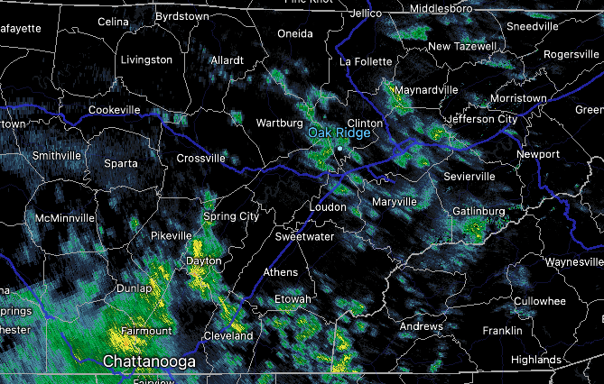
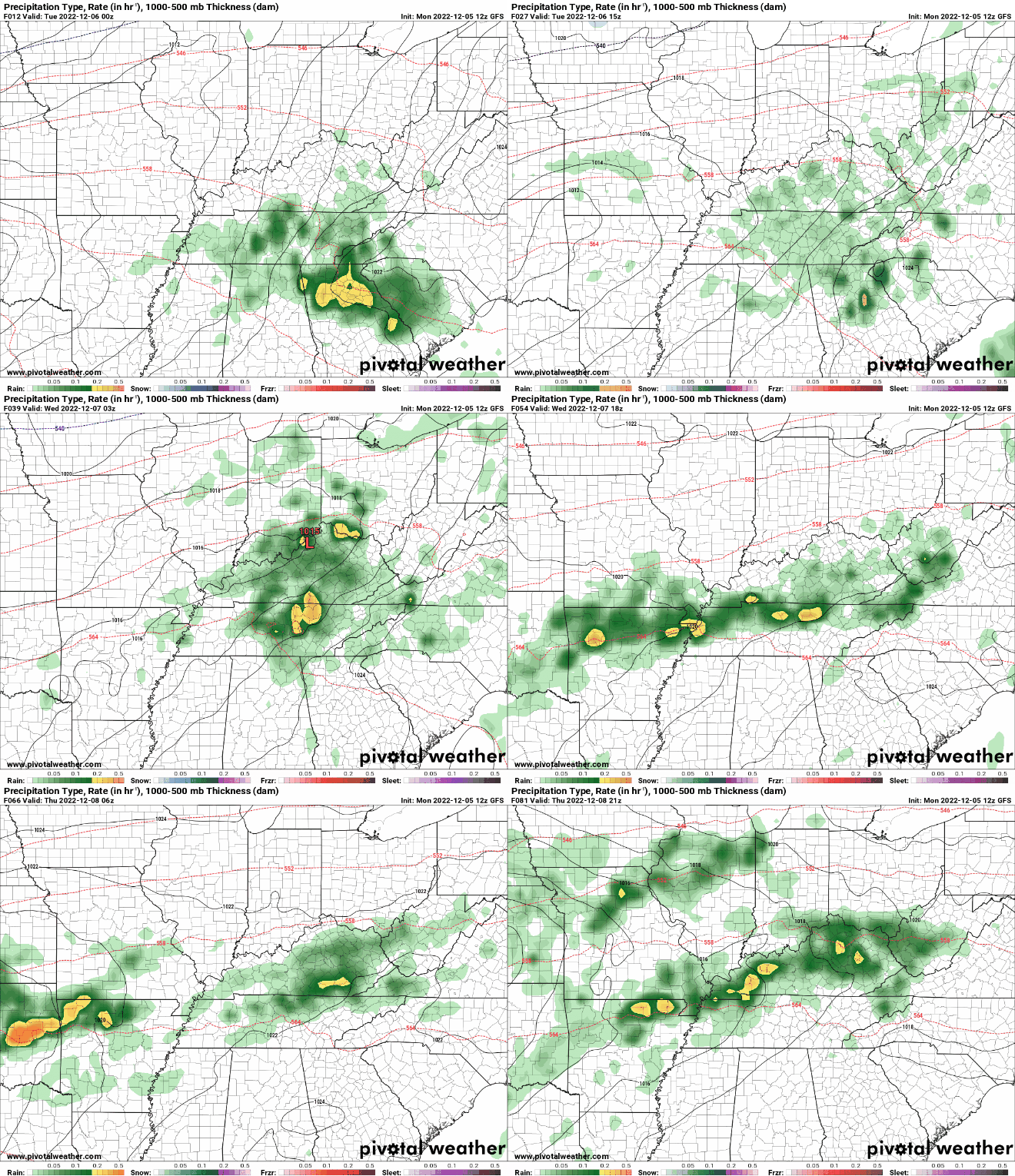
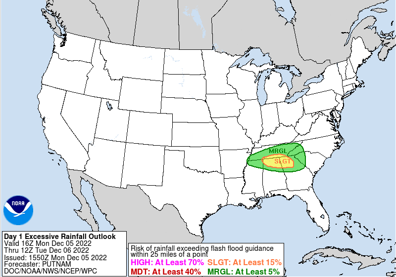
For those heading out from lunch plans, a few light spotty showers are across the area (12:40 pm). The bulk of rainfall is nearer to Chattanooga, with more activity on its way. A warm front is expected to build north tonight, resulting in not only "warm" temperatures tomorrow (60s) but will also allow for widespread showers and storms. This boundary will then stall out across the Ohio Valley tomorrow, acting as a focus for low pressure to develop and ride along through the work week. Intermittent showers and a few storms should be expected. Breaking this down by day.. Today & Tomorrow: the aforementioned boundary will build north today, where spotty showers will turn into widespread showers and isolated storms this evening and overnight. Activity will continue into Tuesday, where things turn more spotty by the afternoon. Temperatures will be chilly today given the cloud coverage, warming to the upper 50s and low 60s by this time tomorrow. Wednesday & Thursday: By Tuesday night, a riding disturbance will bring reinforcing rain to the area, where widespread showers and a few storms will again be likely into Wednesday morning. By Wednesday afternoon, the focus will be for showers just south of the boundary. This will be on a line generally running from Nashville, Tennessee to Lexington, Kentucky. Essentially, counties bordering KY and especially those in the northern plateau will see the best and most consistent rain chances through the day. Friday: By Friday, widespread shower chances return (the first half of the day) as an area of low pressure and associated cold front slide through the area. This will result in cooler temperatures through the weekend, but also a period of drier weather after its passage. Highs will generally fall to the low and mid 50s Saturday and Sunday with broken to partly cloudy skies overhead. So with lots of rainfall in the forecast, what does this mean for flooding potential? Well its definitely a possibility but we have some obstacles to first overcome. First, we have been very dry in the most recent months. We have been battling moderate and severe drought across the state, so several rounds of rainfall will be beneficial to the area. Dry soils will also limit runoff into basins, though in increase in levels should be expected. Next, these showers and isolated storms should be light to moderate and fairly progressive- meaning quick moving. With all of this, any areas that see thunderstorms and/or repeated activity could be prone to flash flooding and localized flooding. The WPC has highlighted a Day 1 Marginal for the whole area, with a slight risk nearer to the warm front across the south. Keep up to date on any warnings issued by following us on Twitter and Facebook. Showers should be expected on and off all week, so have those umbrellas handy. We will eventually see a much needed break this weekend, before another opportunity arrives early next week. For now, relax, enjoy the good "sleeping weather", as well as warmer temperatures the next few days. Pre-recorded for 5pm weather broadcast
0 Comments
Leave a Reply. |
Your trusted source for everything weather in East Tennessee.
Social Media
|


