|
With a very active week ahead, I'll jump straight into it. With a system working through, expecting to dump up to 3+ inches of rainfall today and tomorrow, flash flooding is a major concern. The latest from the WPC outlines a moderate (20% - 50%) risk of flash flooding. Heavier showers are expected overnight tonight as a warm front moves through, so flooding is likely tomorrow morning. Be sure to check in with local officials on what to do if flooding occurs in your area. 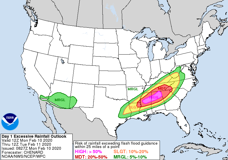 Looking at the latest surface map, this week looks almost identical to last week. Expect rounds of systems bringing heavy rains, severe possibilities, and cold air to cap it all off. Below, a warm front will work through overnight providing lots of rainfall (1-2 inches) into Tuesday morning. Another system from the southwest will bring strong to severe showers/storms Wednesday and early Thursday before cooler and drier air moves in late Thursday and for the day Friday. 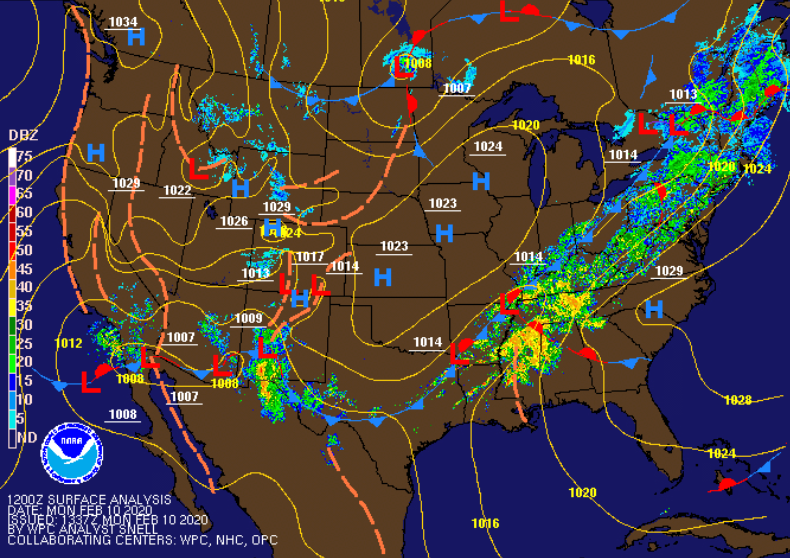 Model guidance shows the moderate to heavy showers expected overnight tonight. Scattered showers are likely into the early afternoon hours as a weak cold front works through. We will get a brief pause Tuesday night with mostly cloudy skies overhead before another system arrives Wednesday. This secondary system will bring the chance for strong to severe storms. Clearing will begin Thursday afternoon with sunny skies and cool temperatures to close the work week off on Friday.  The outlook for Wednesday shows middle to eastern TN under a slight risk for severe weather (2/5). Given the heavy rains expected today and tomorrow, flash flooding will remain a concern Wednesday as well. Damaging winds, heavy downpours, and isolated tornadoes are all possible Wednesday afternoon. 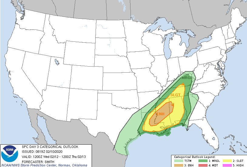 As of noon today we have picked up over 0.85" of rainfall here at the office and more is on the way. I mentioned 3+ inches of rainfall is possible through tomorrow, but up to 7" is possible for the Chattanooga area through this week. Here in the central valley, 3-5 inches is a realistic outlook but locally higher amounts are possible. Regardless of where you are at, flash flooding is a major concern this week, along with the potential for severe weather (Wednesday). Stay active with us here at Secret City Weather as well as with local officials and the NWS. 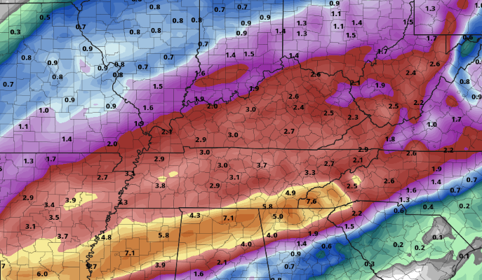 For more details, view our daily video forecast below or email us at [email protected]. If you could help us out with weather reports this week, that would be greatly appreciated it! Simply tag or email us a picture (with location mentioned) or let us know what you are seeing and where. We will relay that information to local officials, the NWS, and other viewers in the area. Stay safe, do your best to stay dry, and stay up to date with us this week.
0 Comments
Leave a Reply. |