|
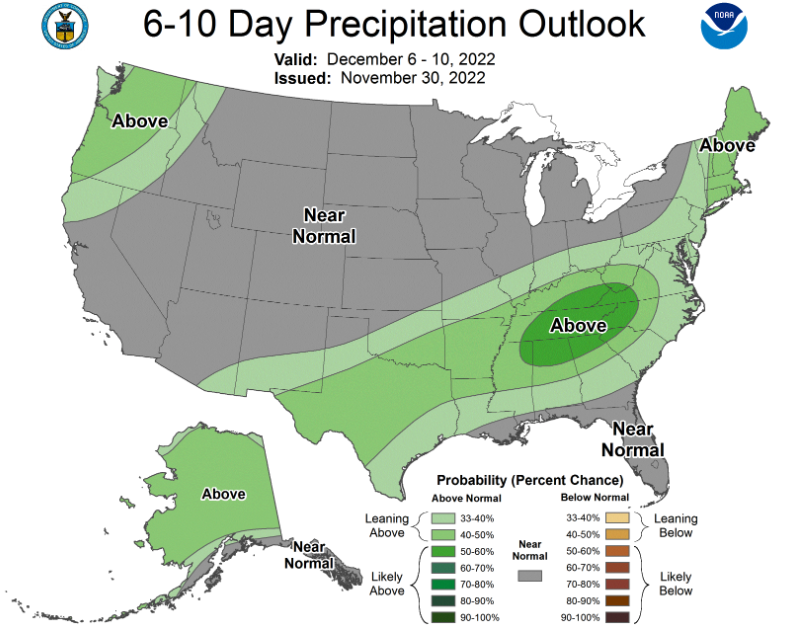
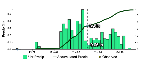
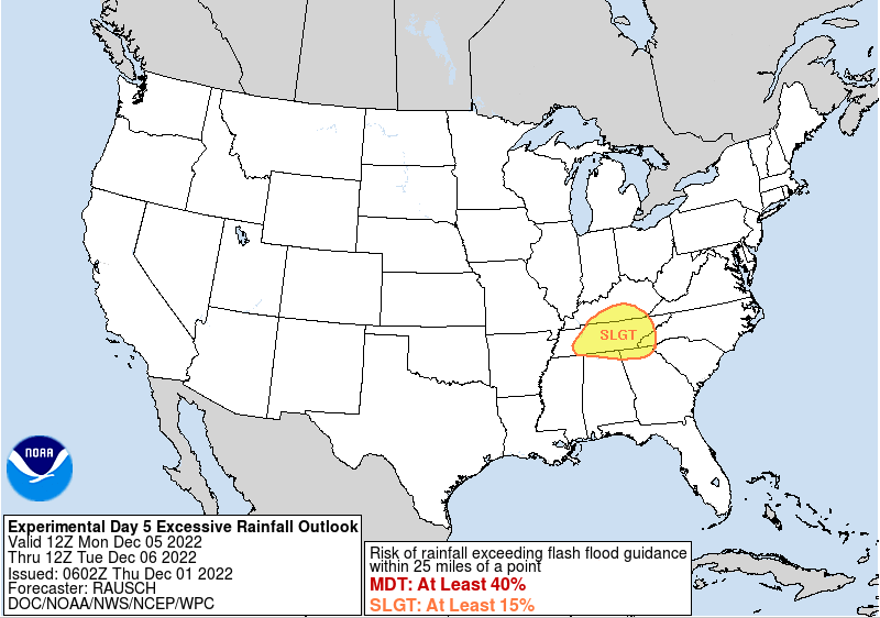
High clouds are passing through this afternoon, lending to partly cloudy skies and temperatures in the low 40s. We will warm a couple of more notches to top out in the mid to upper 40s, before additional cloud cover moves in overnight. This is all due to a cold front that will pass through Friday night and into Saturday morning. Showers are expected with this system, where briefly drier conditions follow Saturday afternoon to Sunday morning. Chances then return as a potentially long lasting rain event arrives late weekend and into next week. Looking at the long term outlook, the Climate Prediction Center has geared their forecast towards a higher probability for above average rainfall between the 6th and the 10th. Essentially, the boundary that pulls through Friday night into Saturday will lift back north and stall out near the area. This will allow areas of low pressure to develop along it and bring multiple shower chances to the region. There is still quite a bit of uncertainty where this boundary sets up, as earlier guidance had this across Kentucky. The trend has been for a further south set up, but exactly where is still in question. Nonetheless, current data has this across the Tennessee valley so it warrants highlighting. Looking at ensemble guidance (multiple model runs synthesized into one), we could see over 3 to 4 inches of rainfall between now and the 7th (Wednesday). Of course, changes are likely but this will be something to monitor. Furthermore, the Weather Prediction Center has released a rare day 5 slight risk of flash flooding. Typically these are in the shorter term (Day 1-3), but the data warrants highlighting the longer term risk. So what does all of this mean? Well, showers look likely but where the boundary and axis of showers develops is still a bit in question. More recent runs suggests across the Tennessee valley, and if that turns out to be the case, we could be in for flooding/ flash flooding concerns. Even with the dry/drought conditions we have been dealing with, 2-3 inches+ in a ~36 hour period could be a concern for flooding potential. The orientation and boundary would suggest training showers/storms as well (which is more favorable for flash flooding potential). We will keep an eye on things moving forward, but do keep in mind the various outcomes. Other than showers tomorrow night into Saturday and again Sunday evening and through portions of next week, temperatures generally stay seasonable with highs Friday and the weekend in the 50s. Be sure to check back in moving forward, as there remains plenty of uncertainty with rainfall/any flooding potential next week (primarily Monday- Wednesday). Pre-recorded for 5pm weather broadcast
0 Comments
Leave a Reply. |
Your trusted source for everything weather in East Tennessee.
Social Media
|


