|
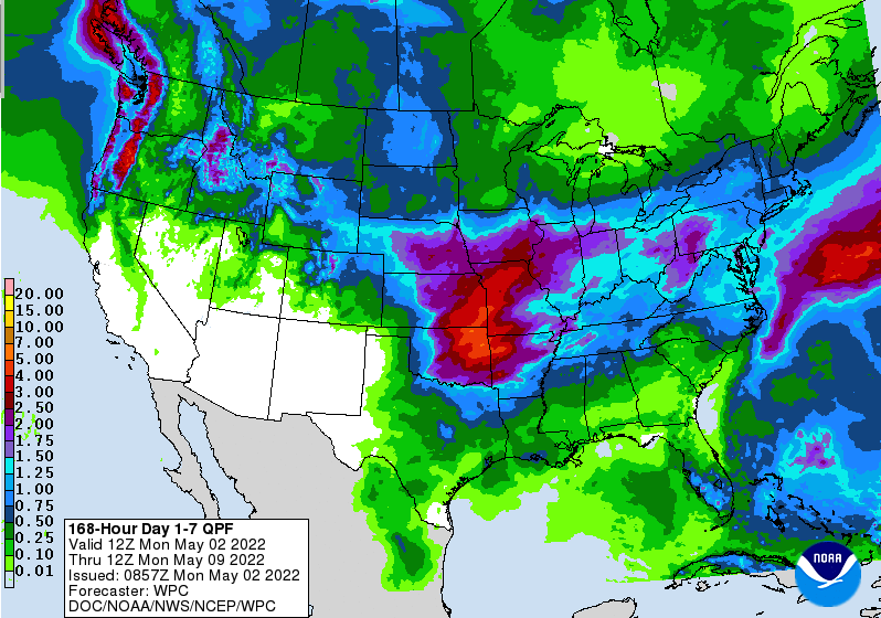
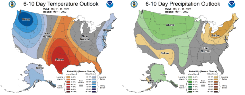
For those heading out this morning, be weary of patchy fog. Overall, it will be a pleasant day and our only real dry day of the week. Two systems will look to target the Volunteer State, bringing showers and thunderstorms at times tomorrow through the weekend. Breaking it down first, showers will overspread the area tomorrow afternoon and continue into Wednesday morning. A brief reprieve from activity will find us the later half of Wednesday, before another disturbance tracks in later Thursday and through the early weekend. Overall, the severe threat is low (at least with round 1) but a few strong storms can't be ruled out. Temperatures throughout will generally be near to above average in the 70s to 80s. As far as rainfall amounts this week, we can expect anywhere between 1 and 2 inches in total. This will provide a good soaking rain before things dry back out later in the weekend and into next week. Looking further into the extended forecast (early to mid May), things look to veer back to near seasonable norms. This is the case for both precipitation and temperatures (which we average mid to upper 70s). Overall, keep the umbrellas handy this week. Showers and storms will begin to arrive tomorrow afternoon and into the overnight as a cold front tracks through the area. Pre-recorded for 5pm show
0 Comments
Leave a Reply. |
Your trusted source for everything weather in East Tennessee.
Social Media
|


