|
Hurricane Eta made landfall late last night in Nicaragua as a category 4 hurricane. This system barreled into the country with 150 mph winds and is expected to bring upwards of 2 to 3 feet of total rainfall now through Friday. As Eta, or what will remain of it by Saturday, works back into the ocean, its next destination is the Caribbean. Luckily, with cooling ocean waters this tropical machine will likely not strengthen much over the course of the weekend and early next week. Hurricane season officially ends November 30th and we couldn't be more glad of that. Not to say hurricanes aren't possible after this date (very much are) but this has been the most active season in history. 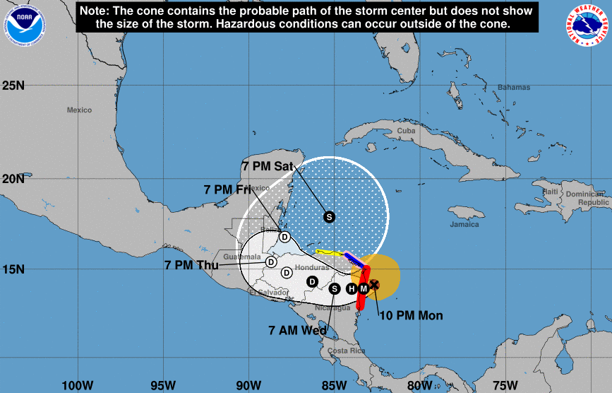 Turning our attention back to home, there is little to discuss over the next several days. High pressure will contribute to warming temperatures in the days ahead, as well as keep things mostly sunny. This would be a great time to get out and about for hiking, camping, hunting etc. Temperatures will be at to above average through the reminder of the week with dry conditions sticking around.  A look at high temperatures tomorrow show's average across the region. A few clouds will linger in for Thursday keeping things again near average before we warm to the 70's Friday and the weekend. This warming trend, as previously mentioned, looks to continue through next week as well. 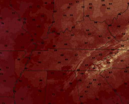 Enjoy the dry air and warming temperatures. Conditions are vastly different than the 3-4" we picked up from Zeta last week. If Secret City Weather can help you or your business is anyway, send us an email [email protected] or visit our "Services" tab above. Pre-recorded for 5pm show
0 Comments
Leave a Reply. |