|
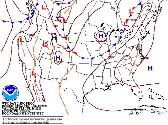
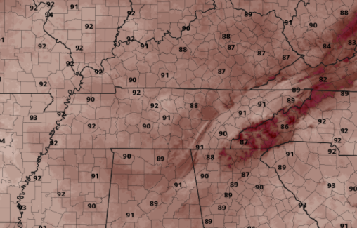
The pattern we are locked in has been very unforgiving. A set of slow moving fronts has led to rounds of afternoon showers and storms. That will again come today and Wednesday before we get a much needed dry day (for most) on Thursday. Again though, more activity will follow. Looking below, a cold front will be working down from Canada, bringing the chance for heavy showers/storms into the weekend. We are still a fair timeframe away but this will likely bring slightly cooler temperatures as well (low 80s). We will keep a close eye on things in the days ahead. With high pressure edging in along the Southeast Thursday, temperatures will ramp up. Most will see highs in the upper 80s to lower 90s, but humidity will make it feel even warmer. We may lose most of the shower/storm threat, but the heat threat remains something to keep in mind. Drink plenty of fluids and stay cool! Afternoon showers and storms will again develop this afternoon and Wednesday with highs generally running near average (mid to upper 80s). Check back in for how our next storm system could play out into the weekend. Pre-recorded for 5pm show
0 Comments
Leave a Reply. |
Your trusted source for everything weather in East Tennessee.
Social Media
|


