|
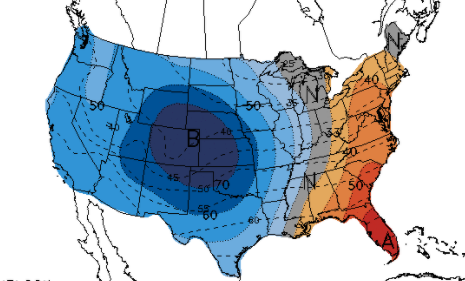
We have officially released this year's East Tennessee Almanac. You can download your copy at SecretCityWeather.com/AlmanacDownload or click the download button below. We are excited to add a few new elements that include a recap of the Easter 2020 tornadoes, our awesome sponsors, and more, so check it all out! Getting into the weather for the day, it has been breezy. Winds are blowing from the south between 5-15 mph with gusts up to 25 mph. The balance between high pressure to the east and a front to our west is forcing in warm and breezy air this afternoon. This will again be the case tomorrow too before a few showers round out the week and the weekend. Looking below, mid to late March is suggested to be right near the norm. A different story is painted for the western half of the USA with well below average temperatures expected. This pattern will likely shift east bringing a cooler than normal second half of March. As for the rain later in the week, waves of systems will pass just to our north bringing isolated to scattered showers Friday through the weekend. We will also see cloud cover move in today and again tomorrow associated with these passing systems. Overall, Friday through Sunday should stay on the cloudier side with a few showers possible each day. Another warm Spring-like day is on tap tomorrow with breezy conditions also sticking around. Don't forget to check out the release of our Almanac as well. Click on "Download" at the top of this post to access the page. Pre-recorded for 5pm show
0 Comments
Leave a Reply. |
Your trusted source for everything weather in East Tennessee.
Social Media
|


