|
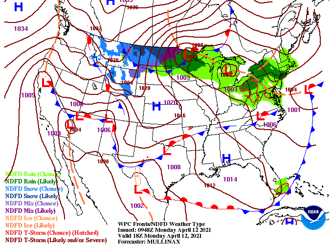
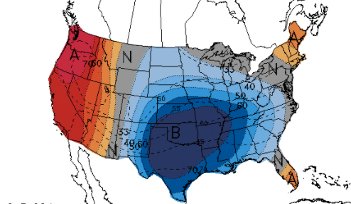
The beginning of the new work week starts with lots of sunshine and above average temperatures. For the pattern, we sit idle between high pressure and low pressure to the north and west. A front will also stall out just to our south as a low develops across Texas and works east. This will allow for the chance to see a few isolated to scattered showers midweek, but rainfall amounts look very unimpressive. Looking at model guidance, dry air remains locked into place through today and much of tomorrow. We could see a few isolated showers arriving by Tuesday night, but the best chances arrive for Wednesday. This model in particular tends to veer toward higher rain chances, so we have dialed back those percentages for Wednesday. Following scattered rain chances midweek, a cool down is in store. Looking at the latest CPC outlook for the 7-10 day range, well below average temperatures look to be the trend. As high pressure and northern flow arrive the second half of the week, highs will range in the mid 60's with overnight lows in the upper 30's and low 40's. Frost will be the biggest hazard with this as some of our deep valleys and higher terrain will be the most susceptible. We begin the new week beautiful but a pattern shift will allow for much cooler air by Thursday and Friday. Find out additional details below. Have a good Monday! Pre-recorded for 5pm show
0 Comments
Leave a Reply. |
Your trusted source for everything weather in East Tennessee.
Social Media
|


