|
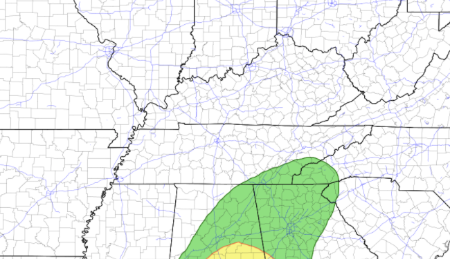
It has been a pleasant start so far today with mostly clear skies and temperatures in the lower 50's. Satellite and local reports suggest some patchy fog near water-bodies, otherwise things are clear and dry across the region. For those who missed it, we did have rounds of severe weather graze the northern Plateau and work into Kentucky yesterday afternoon. Many funnel clouds and signs of tornadoes can be viewed on our social media. The area's hit the hardest includes Scott, Claiborne, and northern Campbell counties. Continue to send us reports if any come in! Working ahead, a low will work back in from the south and west. This next round will pose similar severe threats (isolated) but bring a better chance for rainfall. Looking at model guidance below, isolated to scattered showers arrive late overnight tonight and through a good portion of the day Saturday. The timing for heavier showers and storms comes in the morning to early afternoon. Gusty winds, heavy downpours, and small hail will be the primary threats, but we can't rule out the chance for a few isolated severe cells. By Sunday, we clear back out with warming temperatures into Monday. Mostly sunny skies look to be in the forecast for much of early next week. In additional to the Marginal (to slight) severe risk tomorrow, we also have a portion of far southeastern Tennessee under a marginal risk for flash flooding. With showers expected to "train" along this area, rainfall will likely add up quickly leading to the chance of flash flooding. Use caution if you are along water bodies, low-lying areas, or flood prone locations. That will wrap it up for today...I hope everyone has a good weekend! As always, we'll provide updates via social media through Saturday and Sunday. Have a good one, stay dry, and enjoy the improving conditions Sunday and early next week. Pre-recorded for 5pm show
0 Comments
Leave a Reply. |
Your trusted source for everything weather in East Tennessee.
Social Media
|


