|
Brr, a very cold start across East Tennessee this morning with current temperatures in Knoxville at 23 degrees. Just to the west in the Plateau, Crossville just got over the hump from the teens. We will see improvement in temperatures this afternoon with sunny skies and high's in the mid to upper 40's. 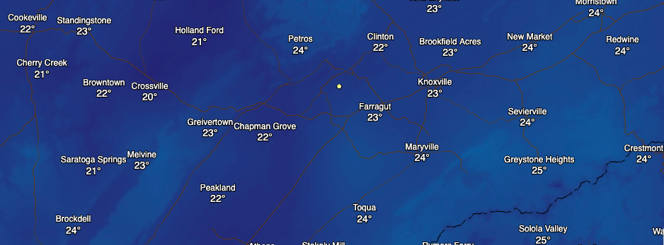 As promised, here is the release of snow totals across East Tennessee from our first snowfall of the new season. Most locations in the valley recorded between half an inch to an inch. The bulk of snowfall, of course, fell in the foothills and smokies with areas as high as 11" for Mt. Leconte. The transition to snow showers came a few hours earlier than previously thought which contributed to some of the higher totals across the region. Overall though, it was nice to see some snow as we transition back to a bit of a warmer phase the end of this week. 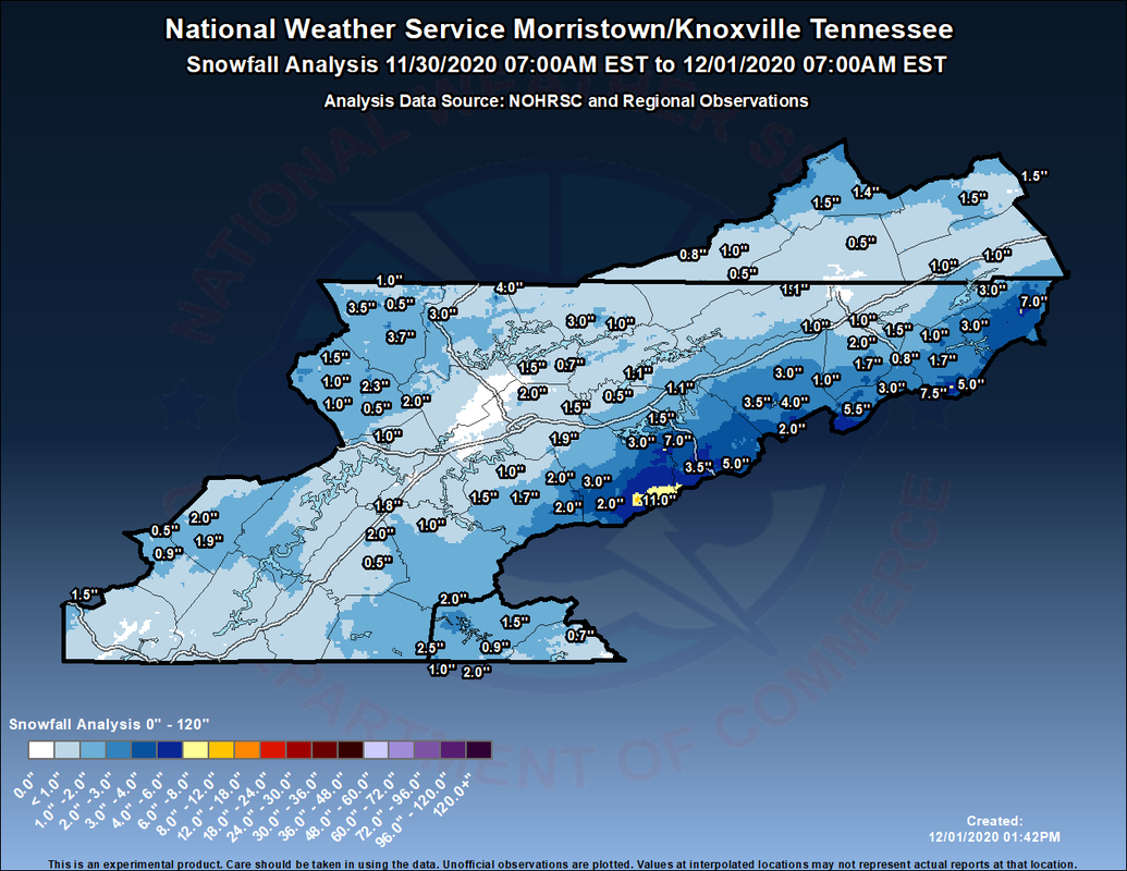 Up next, a system to the west will slide through late Thursday and into Friday. High pressure will dominate now through Thursday afternoon leaving sunny skies and increasing temperatures. By tomorrow afternoon, cloud cover increases as isolated showers make their way in overnight and throughout Friday. This system overall looks pretty weak with isolated to scattered showers throughout the day to end the work week (Friday). A few snow flurries can't be ruled out overnight Friday and Saturday, but no impacts are expected. We will transition back to clearer skies for your Sunday before another system brings the potential for rain and some snow showers Monday and early next week.  For now, do your best to soak in some rays and stay warm. We will have improving temperatures with high's tomorrow in the 50's. Have a great day everyone!
0 Comments
Happy Tuesday and I hope you are staying warm this morning. The low that brought rainfall and eventual snowfall yesterday has worked into New England. Official totals have not been released yet but I will get those out when the NWS provides it. Looking ahead, we'll look to dry back out today and tomorrow with high's staying well below average (upper 30's today & upper 40's tomorrow).  Model guidance continues to show some light snowfall into early this afternoon for the higher elevations of eastern Kentucky and northeastern Tennessee. Continuing through the day, gradual clearing will take place leaving clear skies and very cold temperatures overnight tonight and into Wednesday. For the most part, things stay dry now through the first half of Thursday before another low and trailing cold front bring reinforcing air. This next shot will more or less keep temperatures as is in the upper 40's to lower 50's through the weekend. In addition, we could see a few isolated showers to snow flurries before sunnier skies return late weekend and early next week. 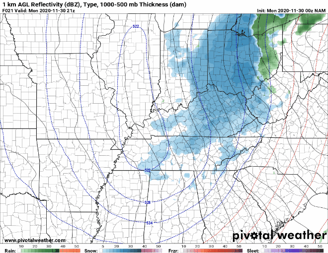 As hinted in today's post title, the coldest day of the week is upon us. Though temperatures fell through the day yesterday, overnight low's will find themselves in the teens and lower 20's. Model guidance, seen below, is more conservative than what I am thinking. With clearing skies overnight I anticipate most elevated locations to be in the mid to upper teens and valley locations in the low 20's. Overall, it's going to be a very cold night so dress warm into Wednesday morning. 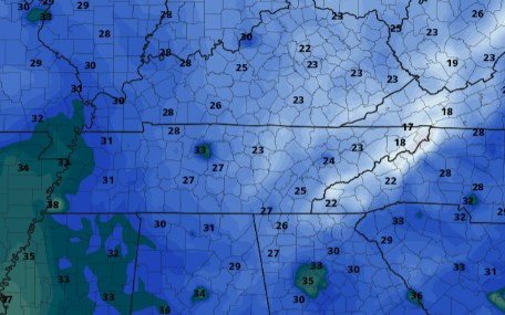 That will do it for today but stay warm overnight tonight. Low's for some will likely be in the mid to upper teens. If Secret City Weather can help you, let us know by visiting our "Services" tab above or shooting an email to SecretCityWx@aol.com Pre-recorded for 5pm show
|