|
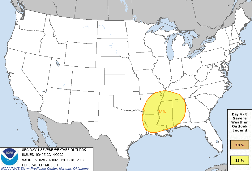
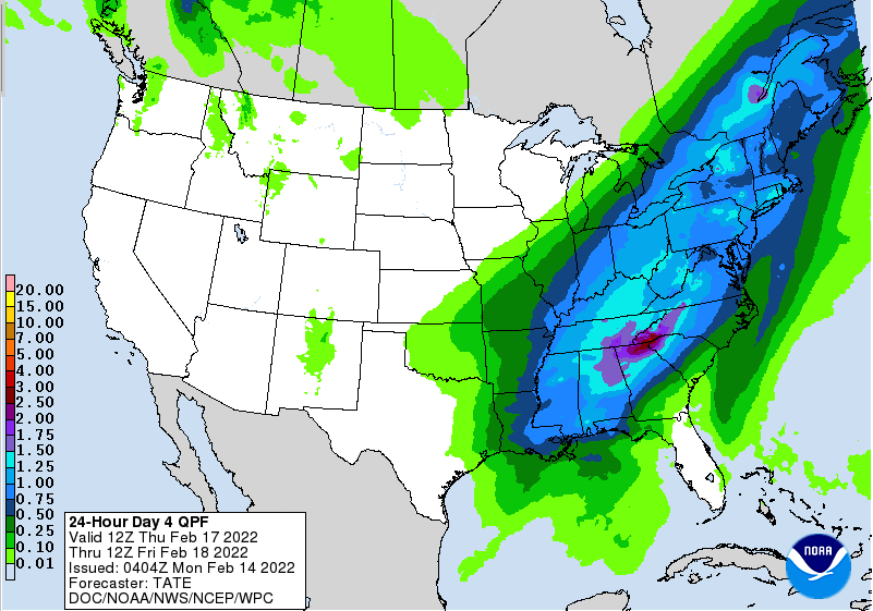
A chilly morning starting out, but travel looks pretty calm so far. Current temperatures sit in the mid 20s, but we'll warm to see highs in the mid to upper 40s this afternoon. Mostly sunny skies will also accompany making things feel pretty seasonable. We are eyeing the potential for some early season severe activity, as the SPC has issued a 15% chance on Day 4 (Thursday). The trend has been a slight eastward shift (due to timing), so we will continue to watch this closely. A sweeping cold front, combined with strong winds, and ample warm and moist air, will allow for the development of strong to severe storms during the day. The biggest impacts will be strong to severe winds, heavy rainfall, thunderstorms, hail, and isolated areas of spin-up. Be sure to tune back in as we will have better details as we get closer to the event. In addition to thunderstorms, heavy rainfall will also accompany this system. Looking at just Thursday, East Tennessee could pick up 2 inches of rainfall for the day. This will likely come with a flash flooding/flooding issues, so I would not be surprised to see the WPC issue a marginal or slight outlook for their Day 3 (Thursday) tomorrow. Leading up to the event late week, skies will be mostly sunny and warm. Highs today will be in the mid to upper 40s, but mid to upper 60s by Thursday. Take advantage of the warmth now, cooler air follows Friday. Remember to check back in for the latest regarding this storm system Thursday. Some cells could be strong to severe and we'll have better details on the where/when and expectations in the days to come. Pre-recorded for 5pm show
0 Comments
Leave a Reply. |
Your trusted source for everything weather in East Tennessee.
Social Media
|


