|
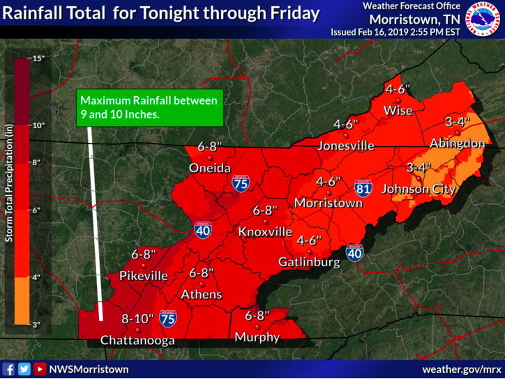
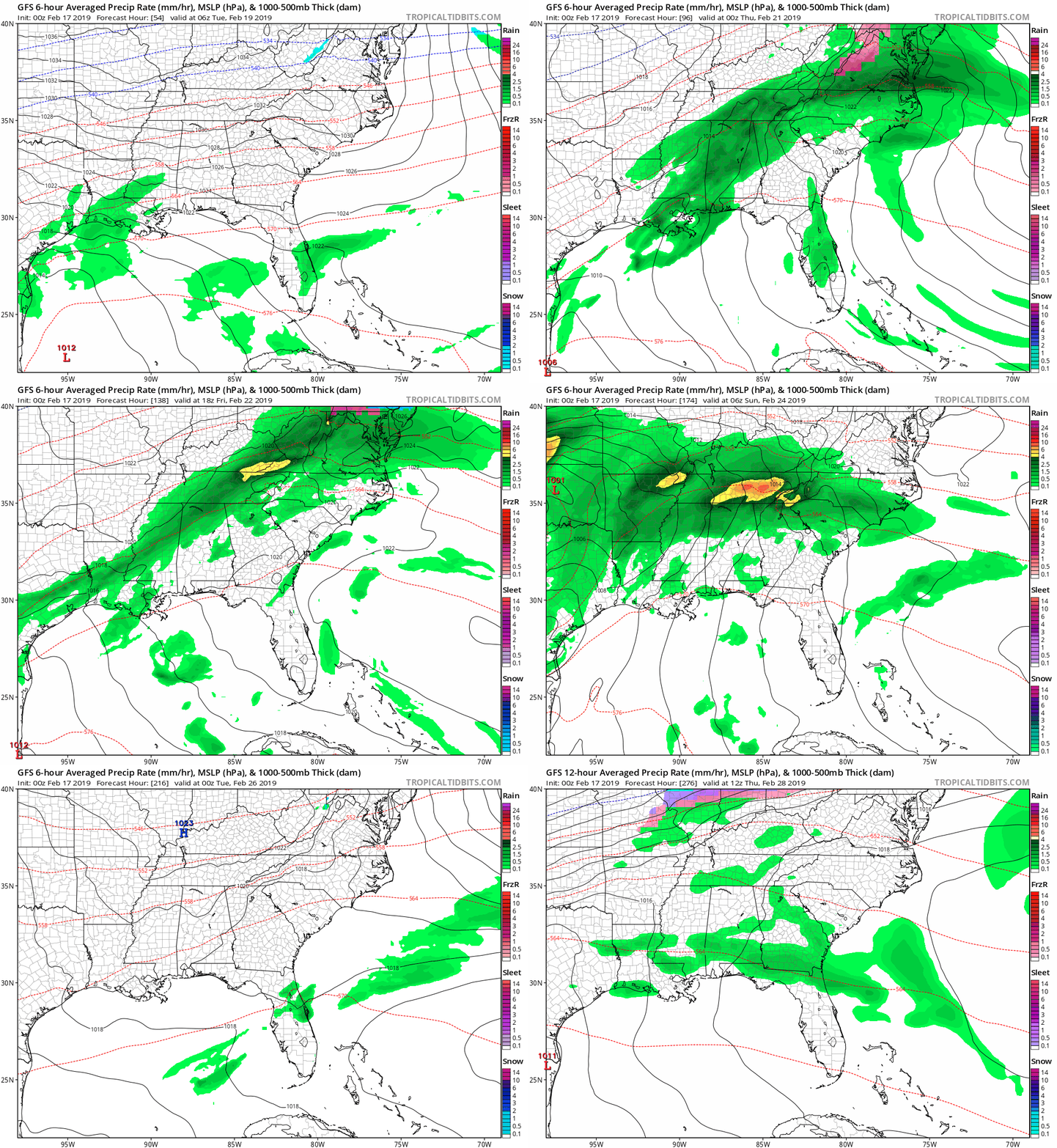
Forget the cars and break out the boats, as that may be your only way of getting to work this week. This may be a slight exaggeration, but it will be a very wet week. A series of low pressure systems will be working their way through our region this week bringing lots of moisture with it. It is important to note the potential hazards these systems will bring. Below you can see the rainfall potential from Sunday until Friday. The hazards associated this week are the potential for flooding and/or flash flooding. TVA worked today releasing water in preparation for this weeks rain so that the dams were less likely to overflow. I expect flood warnings and watches of some kind to be released by the National Weather Service (NWS) sometime this week. As always I will keep you updated of these as they come about. As for this week, it will be a spring like feel with temperatures mainly in the 50's during the day and 40's at night. Today showers will begin in the morning and be scattered throughout the day. Into tonight, showers will become more constant. Expect a high today in the mid 50's with a low near 40 overnight. President's Day (Monday) will be the best day for any outdoor activities or errands that need to be done. High's are expected to be in the low to mid 50's with partly cloudy skies. Moving into Monday night, clouds will increase and leave a low around freezing (32 degrees). Tuesday will be mostly cloudy for the first half of the day with showers moving in early afternoon. This rain will funnel in from the Gulf and stick around until the weekend. Below is the GFS (Global Forecast System) model run from Monday evening until Sunday evening when the rain is expected to finally move out. Stay save and dry this week as there is likely to be flooded areas throughout east TN. I know the phrase may be old or over used, but "Turn Around and Don't Drown". As always I will keep you updated here and on our Twitter with the latest changes, expectations, and alerts that may come this week! Also don't forget to check out the "Weekly Forecast" tab with what you can expect daily. Sources: NWS and Tropical Tidbits
0 Comments
Leave a Reply. |
Your trusted source for everything weather in East Tennessee.
Social Media
|


