|
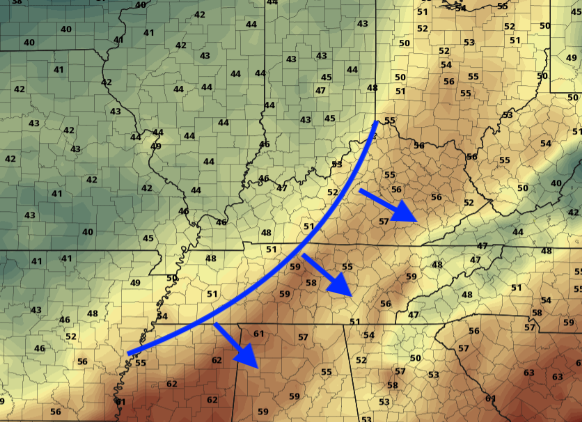
Things have started crisp and cool and will turn out to be beautiful as the day progresses. Temperatures will be right around the average (low to mid 60's) under sunny skies. An update on the Tennessee drought map shows average (normal) conditions across the state (good news for this time of the year). As we make a push towards the weekend, things stay pleasant for Saturday with high's in the mid to upper 60's. A few clouds will work in by the evening hours as a front to the west draws near. As we get into Sunday, a thin line of light showers will find its way in. The bulk of activity will be for the northern half of East Tennessee with amounts up to 0.1 inches. This will be a quick moving system but what follows is the main story. Temperatures to begin the day Monday will be in the mid 30's and won't increase too much throughout the day. The long wait for that "Fall feel" is finally over as a strong front (depicted below) pushes across the region. Temperatures will stay below average the first half of the week before a warming trend once again returns towards the middle part of November (more details in our daily video below). Enjoy a beautiful end to the work week as well as the first half of the weekend. A few showers are possible Sunday, but don't let this dampen your day as they will be quick moving with little impact. Our main weather focus comes next week as a secondary blast of cold air returns. Have a great weekend!
0 Comments
Leave a Reply. |
Your trusted source for everything weather in East Tennessee.
Social Media
|


