|
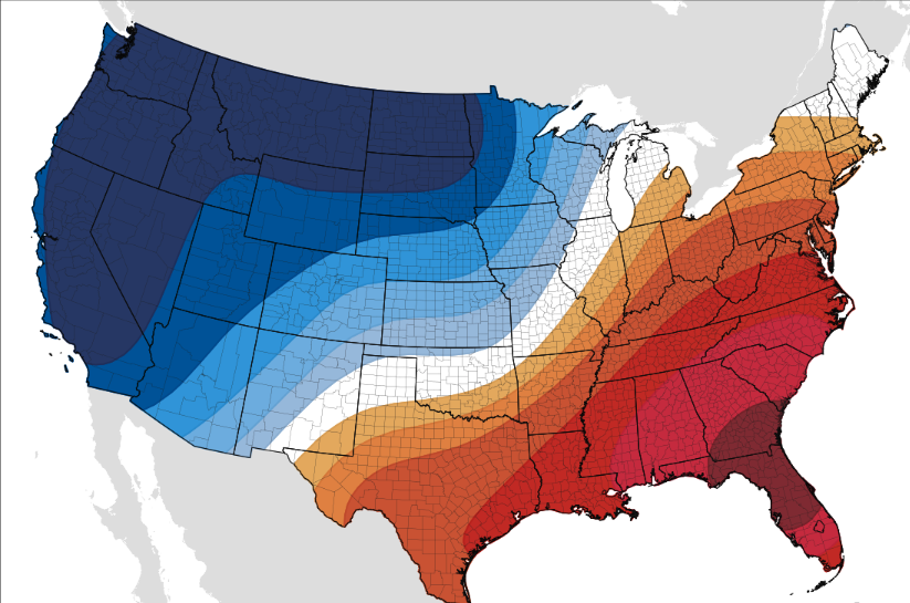
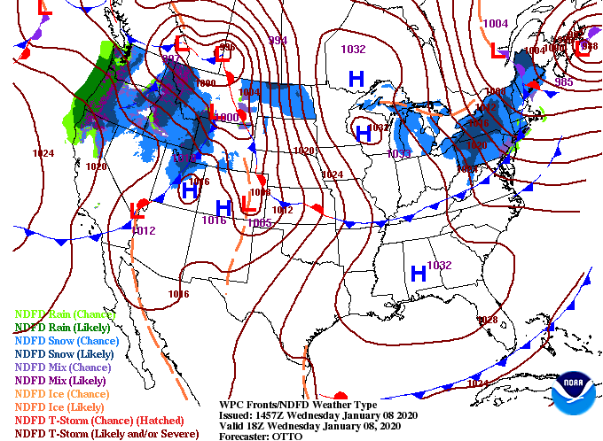
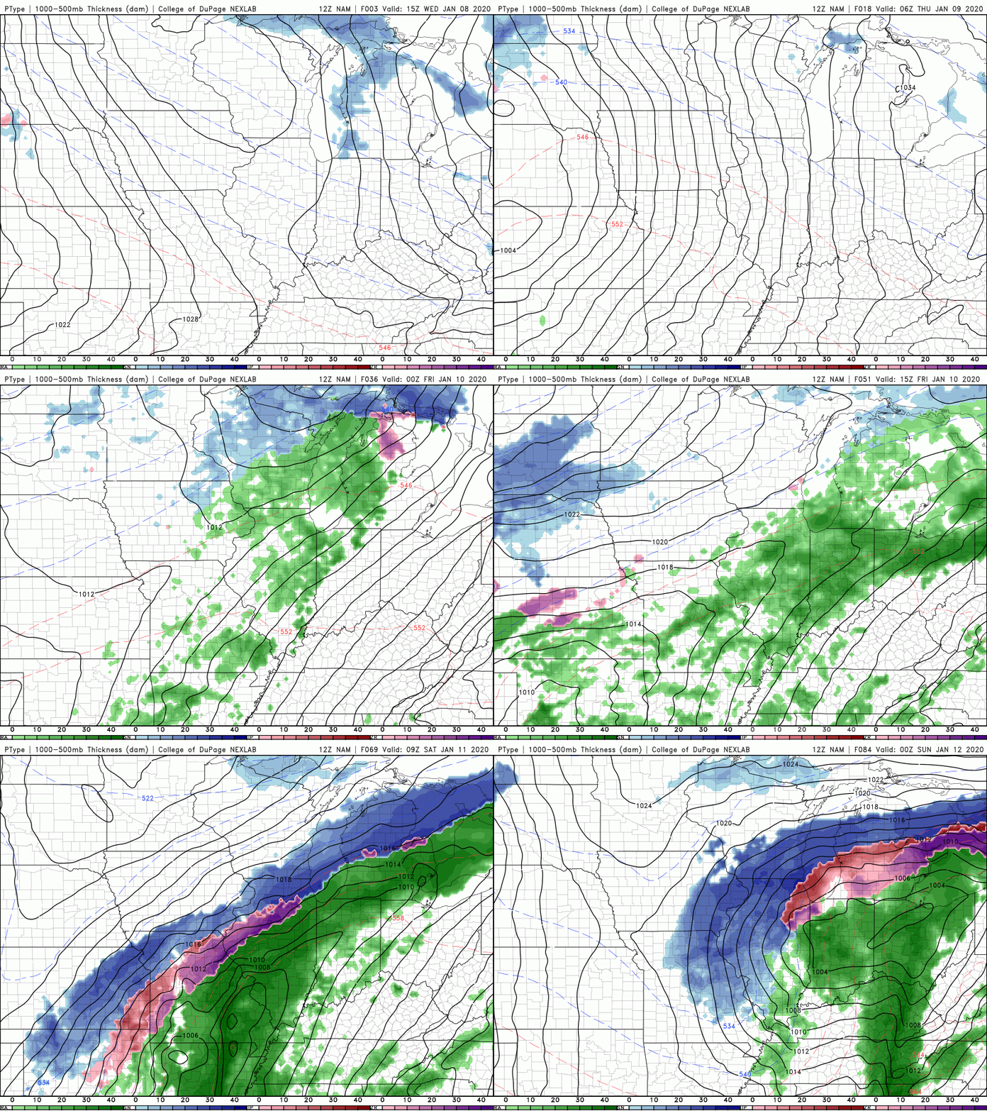
Another gorgeous day today, so I hope you are out enjoying it when you can. If we first jump into the longer-term, the CPC for the middle of January shows above average temperatures continuing for the east coast. I know, like me, many are wanting a big shot of cold air and the chance for some snow. I promise colder air is on the way for late January and into February, we just have to be patient and let winter catch up. As for right now, ridging continues to take place across the region, meaning sunny skies and warm temperatures stay in tact for Thursday as well. As we get into Friday and Saturday, a system to the west will provide the chance for stronger storms (even some severe storms) to work through before we clear back out on Sunday. As we saw from the surface map, dry air stays around today and tomorrow. Friday, scattered showers arrive by the afternoon and heavier showers and storms arrive Saturday. As discussed yesterday, timing and the dynamics play a major role for severity here in east TN so continue to check back in. For now, we are on the weakening side of the system (good news) but severe weather (damaging winds, flash flooding potential, and isolated spin-up) can't be ruled out. We will continue to eye the evolution of this next system as we near the weekend, but until then, enjoy these seasonably warm temperatures and beautiful blue skies.
0 Comments
Leave a Reply. |
Your trusted source for everything weather in East Tennessee.
Social Media
|


