|
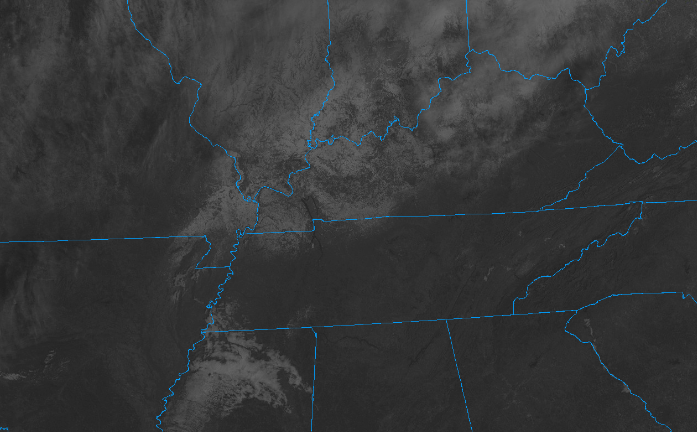
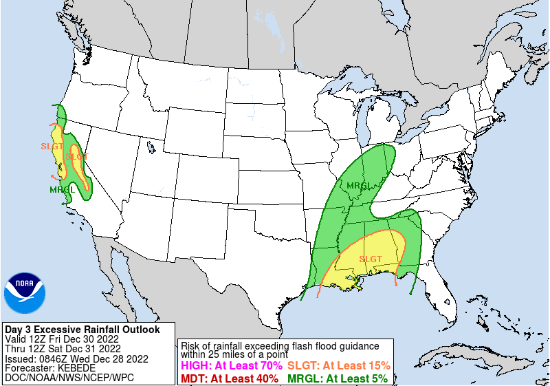
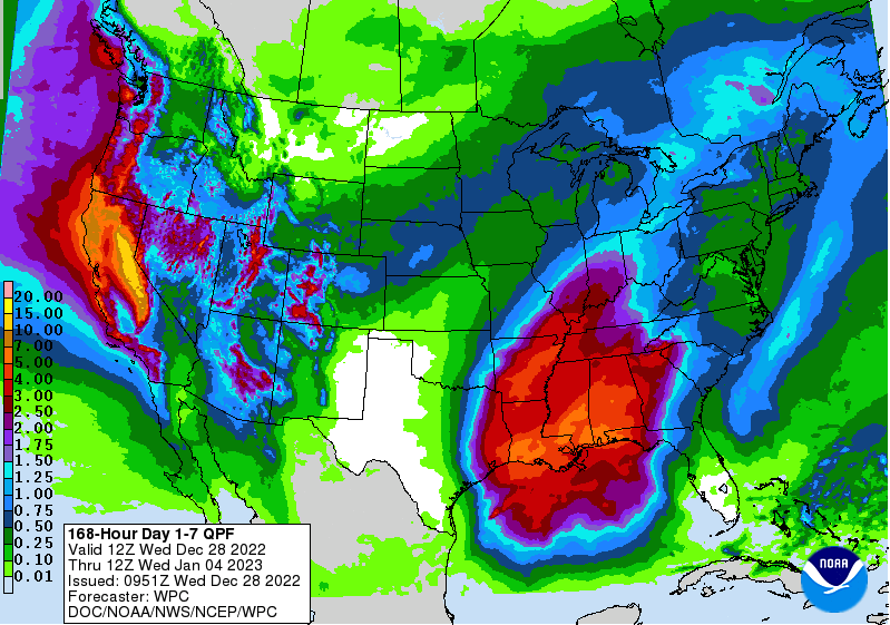
Good morning! After those starts in the single digits to low teens, mid 20s to low 30s almost feels "warm". Nonetheless, a beautiful day is on tap, with plenty of sunshine and highs in the upper 40s and low 50s (average). Looking at the latest satellite scan (10 am), sunny skies will continue to prevail. I will note something neat to our north: most of that white across Western and Central Kentucky is actually lingering snow. It is challenging to distinguish clouds from snow on a still image, but take my word, there's more snow than clouds to our north and west. Looking ahead, dry conditions will hang on through at least Friday morning, before an approaching low and cold front bring rainfall to the area. WPC is highlighting a low end risk for flash flooding across the southern valley Friday night, but I think the risk is very low for all overall. The system should be fairly progressive, generally dumping moderate rain at times Friday night and into the first half of the day Saturday. Soundings do indicate a convective component, meaning a few thunderstorms will be possible as well. If this happens to be the case, then we could see where a low end threat of flash flooding is possible. As it stands now most can expected between a tenth and half an inch, but locally higher amounts within any thunderstorms is likely. This system will be one of a few into the new year, so flooding/flash flooding concerns do grow after this weekend and into next week. This is the 7-day rainfall outlook from WPC, where 2-3" is possible now through next Wednesday. The axis of better rain, for now, appears to be off to our south and west, but is something we will monitor moving forward. Blocking high pressure off the SE coast will allow for an active and wet pattern for at least the first week of the new year which could lead to hydro related issues. For now, impacts are very low and we will have more confidence and details as things better come together. Enjoy the warming temperatures and sunshine today and tomorrow. Cloud cover moves back in Friday, leading to showers early into the weekend. For now, things look dry enough to enjoy any New Year's plans Saturday night and into the day Sunday. Have a good one and don't forget to follow on Twitter and Facebook if you haven't already. Pre-recorded for 5pm weather broadcast
0 Comments
Leave a Reply. |
Your trusted source for everything weather in East Tennessee.
Social Media
|


