|
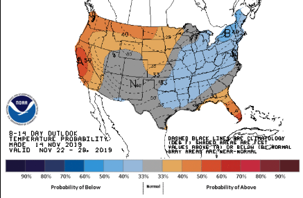
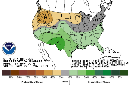
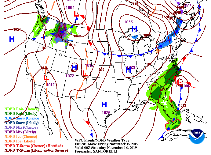
We will finally be ending the week on a warmer note with high's this afternoon in the lower 50's. Cloud cover will continue moving out as the system to our east moves north. Taking an extended outlook into the end of November, the Climate Prediction Center suggests slightly cooler than average temperatures (low to mid 50's range) and slightly above average precipitation. As for the next few days, the system to the east will move north allowing for a high to fill its place. This will bring sunny skies and warming temperatures into the weekend. By early next week, we will have another system to the north bring cloud cover the later half of Monday and the chance for an isolated shower early Tuesday. We will then quickly clear out Tuesday night allowing sunny skies to return by mid-week next week. Model guidance shows the movement of these systems through the weekend. To the east, the low pressure system will move north forcing in a high. As we get further into the gif, a system in the Great Lakes region will bring some cloud cover the later half of Monday and the chance for an isolated shower overnight and into early Tuesday. Following will be another high that will keep things dry and sunny. We will also warm, looking to be back around 60 degrees by mid-week next week. It will be a beautiful weekend to get out and enjoy the outdoors or see the Garth Brooks concert tomorrow night. It will stay on the cool side once the sun goes down so dress warm, but overall going to stay dry the next several days. Have a great weekend and share your outdoor adventures with us!
0 Comments
Leave a Reply. |
Your trusted source for everything weather in East Tennessee.
Social Media
|


