|
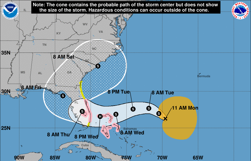
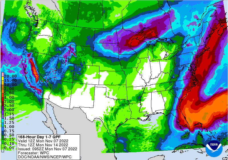
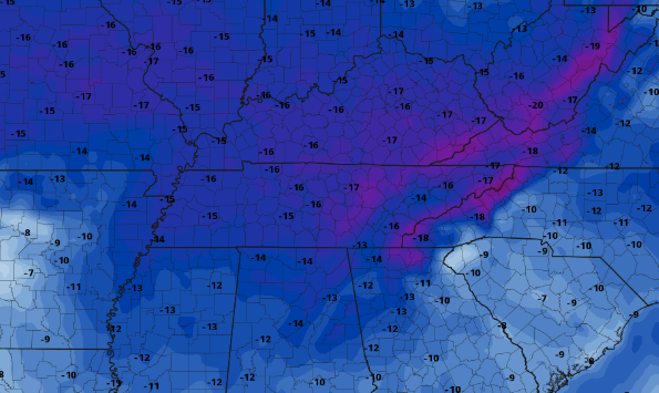
Good afternoon! Monday has once again returned, but so has activity in the Tropics. Tropical Storm Nicole has developed east of Florida and is expected to take a sharp left (westward) turn. This system could increase into a lower end hurricane midweek, before making landfall across Florida and bending back northeast. Eventually, this will ride the coastline, where we could see some very limited rainfall from this system. The highest probability is across the far east, where the valley and plateau see little to any chances. Time will tell, as these tropical systems are very complicated and challenging to pinpoint this far out. Assuming things hold as is (though changes likely), rainfall amounts will vary between up to a tenth along the TN/NC/VA border, to maybe a few one hundredths further west. Unfortunately, this will be our only rain opportunity over the next week, so count on increasing drought and wildfire concerns. Fires have already begun popping up across East Tennessee, and you can almost guarantee more are on the way. Once this tropical to sub-tropical wave works north, an upper level trough will push the system east. As it does so, MUCH cooler air will return to the region. We are near record setting highs this week, but we will quickly flip to 10-20 degrees below average this time next week. Highs will range from the 40s to low 50s beginning this weekend and continuing into at least early next week. Whats that mean? Take advantage of the warm temperatures we have now because changes are on the way! This will also add another wildfire concern as chilly dry air settles in, followed by warming around 10 days for now. As always, we will keep you updated on the latest, so be sure to check in tomorrow. Give us a follow on Twitter/Facebook as well @SecretCityWx Pre-recorded for 5 pm weather broadcast
0 Comments
Leave a Reply. |
Your trusted source for everything weather in East Tennessee.
Social Media
|


