|
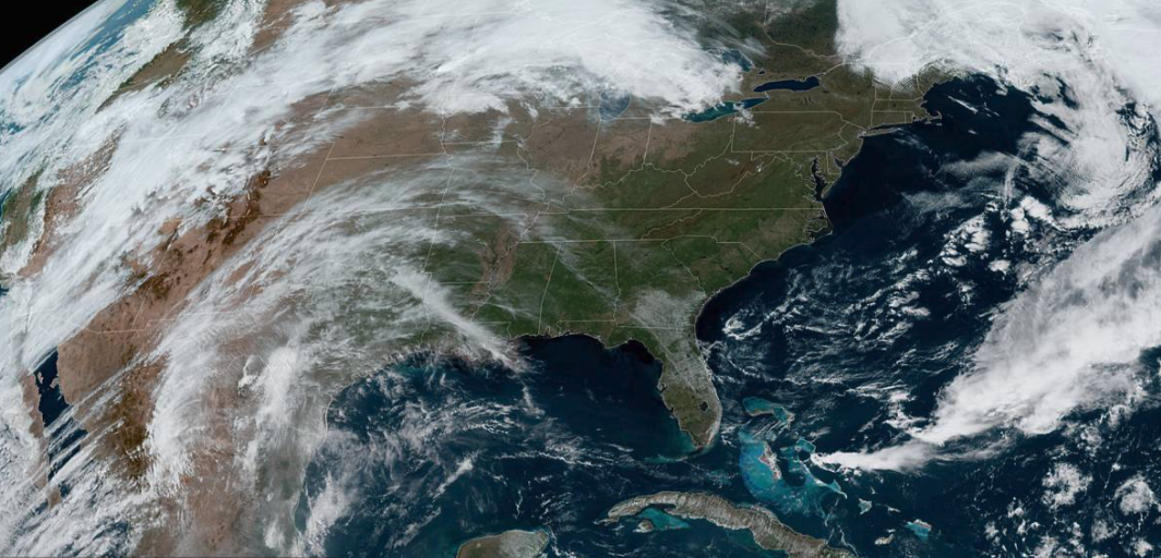
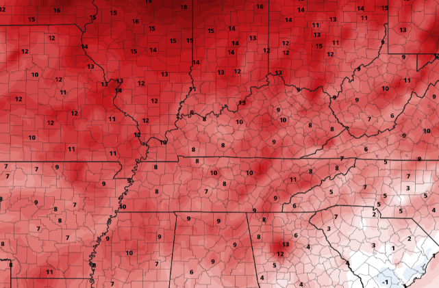
Good afternoon! A beautiful day is in production with lots of sunshine and warm temperatures to accompany. We are seeing temps across the valley in the mid 60s and will warm to highs nearing 80 degrees. A look from GOES-EAST satellite depicts a nice view of the eastern half of the US with light cirrus working in from the west. Jumping into Tuesday, an area of high pressure sits just off the coast of the Carolinas, pumping in very warm, summer-like, air. We'll see highs tomorrow nearing the 90 degree mark for some. Across the Valley, highs are expected to top out in the mid 80s. Looking at how this compares with the norm, we'll be 10+ degrees above average Tuesday and Wednesday. Aside from the warm air we see Tuesday and Wednesday, another system will round out our week. Cloud cover will be on the increase the second half of Wednesday (potentially tampering with highs slightly). By Thursday, showers will beginning working in from the west. Timing looks to be the second half of the day but a few isolated showers can't be ruled out early. By the evening, widespread showers and a chance for lightning and thunder are possible. As a cold front works through Friday, cloud cover will begin clearing out just in time for the weekend. The biggest trend early this week is the heat. Highs average the mid 70s this time the year and some locations could near 90 tomorrow afternoon. Protect yourself from the heat and remember to drink lots of water if you are outdoors for extended periods of time. Showers and a cold front will cool things off by Friday before drier weather prevails into the weekend. Pre-recorded for 5pm show
0 Comments
Leave a Reply. |
Your trusted source for everything weather in East Tennessee.
Social Media
|


