|
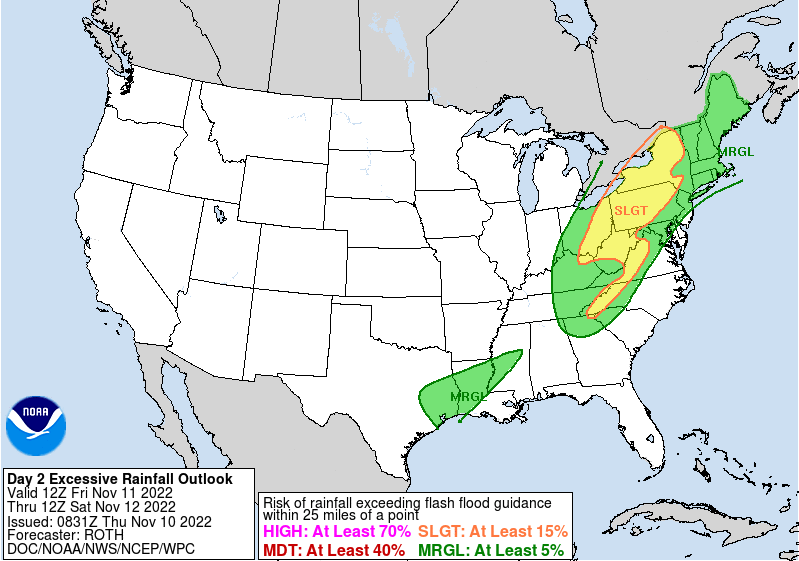
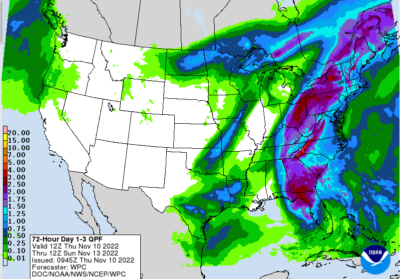
Good morning! Clear skies start off our day, but changes are quickly coming. Remnants of tropical system Nicole are working up the eastern coastline and will allow for cloud cover to overspread the area through today. This will also lead to showers later this afternoon, with chances very high by tonight. Looking at the flash flood potential, it is low. This is not a shocker, as we have been very dry the past couple of months. Nonetheless, WPC does highlight the risk, so do use caution and adhere to any potential warnings. I think this is more or less a precaution given the tropical moisture associated, and we see little issues overall. We shall see, but we will keep you posted nonetheless. Looking at rainfall amounts with this system, you can expect somewhere between 1 and 2 inches, will locally higher amounts certainly possible. Guidance has continued to highlight (as we will see below) a swath of higher amounts associated with a sweeping cold front from the west. The combination of the approaching cold front and tropical system will bring a much needed soaking rain and then a BIG temperature change. Here is the progression of the system. Showers will arrive later this afternoon, overspreading through the night and into the first half of Friday, before becoming more scattered in the afternoon and petering out overnight. Cooler air then takes hold this weekend, with gradually clearing throughout Saturday. Highs will run in the 40s and low 50s Saturday and through at least mid week. As noted, a swath/band of heavier precipitation (denoted yellows & oranges) along the front and tropical system could bring higher rainfall amounts to portions of the area. Overall, several different things to keep in mind. Rainfall is a plus but it will be followed by very chilly airmass. A 30+ degree swing in temps will take place and this does not account for overnight lows dipping into the 20s and even teens for some locations. Be ready to exchange that raincoat for a winter one! Pre-recorded for 5 pm weather broadcast
0 Comments
Leave a Reply. |
Your trusted source for everything weather in East Tennessee.
Social Media
|


