|
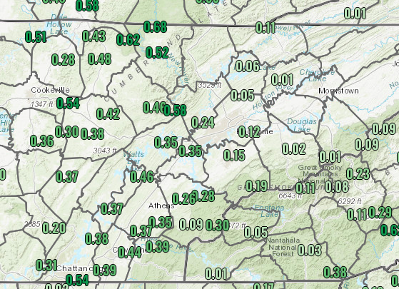
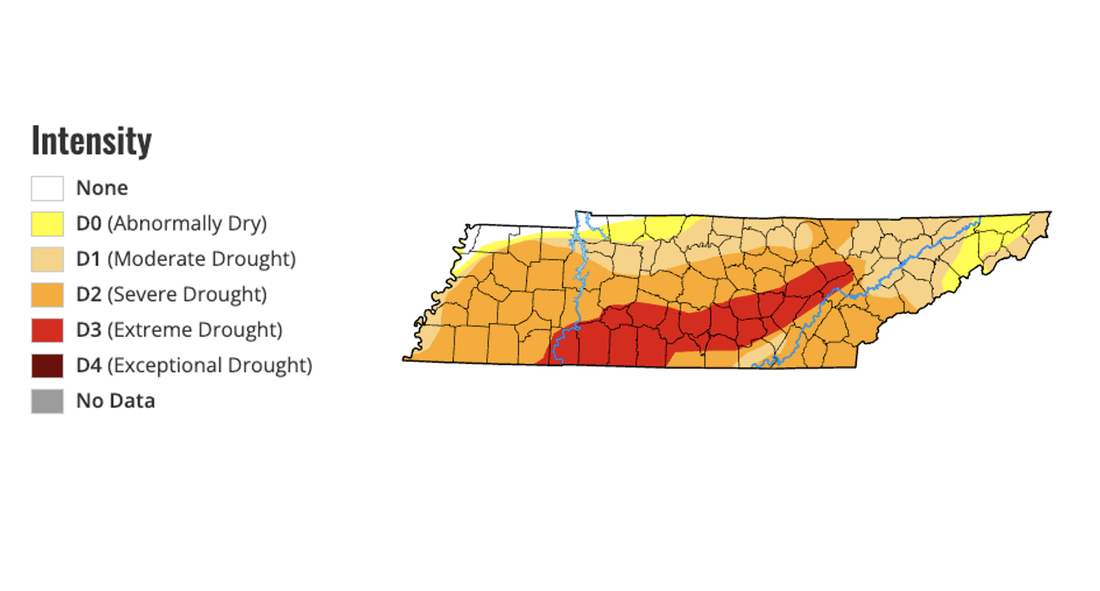
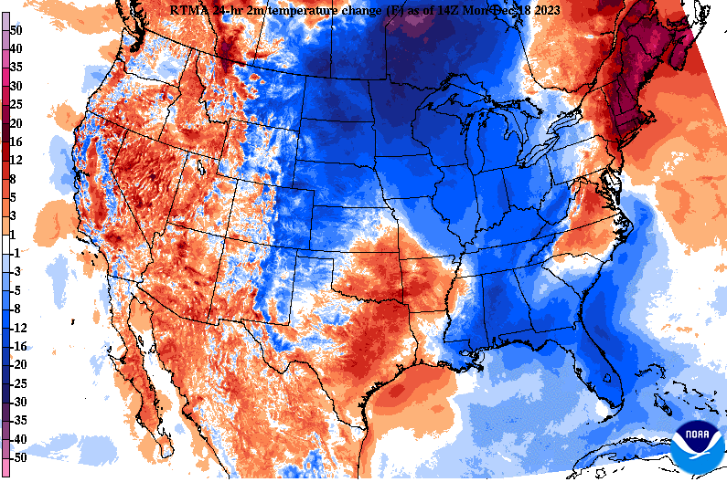
Good morning! After being sparse with updates from being on vacation, we are back. Looking at our latest bout of rainfall, and it was beneficial. Most locations along and west of I-75 picked up between a quarter and half an inch, while those east really varied from a tenth to a few hundredths. Nonetheless, the west was where rain was most needed, so we are fortunate to have gotten that. Moving forward, it's going to be a chilly one (further details below). In response to the rainfall, here is what our current drought map looks like. As you can see, those across the Plateau and through south-central TN are the driest (extreme drought), so the rain was a great thing there. Elsewhere, severe drought still has a grip on the state and more rain is needed in the weeks to come. Moving into the forecast ahead, a cold front is moving through now. MUCH cooler air is being ushered in from the Northern Plains and Canada, where highs will be well below average today and Tuesday. A weak upper level disturbance is passing through the Ohio Valley this afternoon, where a few sprinkles transitioning to flurries will be possible. No accumulations are expected across the valley, but a dusting (on mainly grassy and elevated surfaces/objects) are possible into tonight for the plateau and locations bordering Eastern Kentucky. Those in the foothills and northeast could see up to half an inch, while the highest peaks of the Smokies could see a few inches. Aside from a few snow flakes or snow showers in portions of the area, temperatures will be frigid. Lows tonight will fall into the upper teens to low 20s, with breezy northwest winds making things feel closer to the low teens to even single digits for some locations. Bundle up if heading out early tomorrow, as it will feel very cold to start off the day. Highs will struggle to warm as well, peaking in the upper 30s to around 40 degrees Tuesday. Fortunately, sunshine does return and warmer air will also follow mid to late work week. Highs will climb back to around average by Thursday and last through at least the weekend. Check out our video forecast below for more information. Pre-recorded for 5pm weather broadcast
0 Comments
Leave a Reply. |
Your trusted source for everything weather in East Tennessee.
Social Media
|


