|
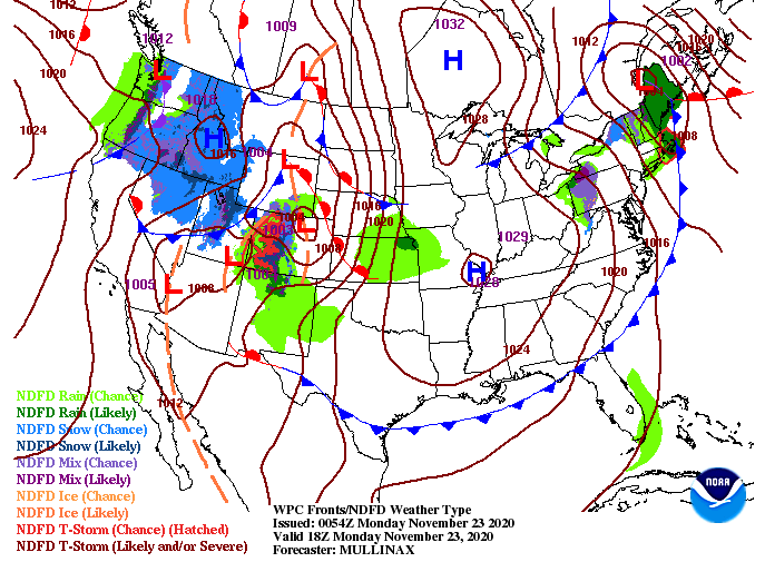
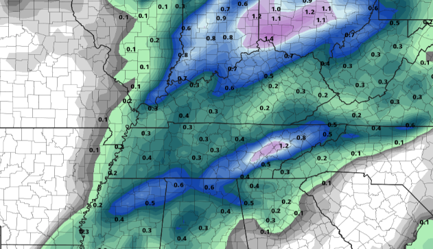
A great Monday morning to you! With the passage of a cold front last night, much cooler air has pulled in and we'll see that this afternoon. High's are expected to only top out in the low to mid 50's, so stay warm. A look at the latest surface map has an area of high pressure just to the west followed by another weather maker in behind it. Things stay dry and mostly sunny today and tomorrow before rain returns Wednesday. Similar to what we saw last night, a line of showers will arrive the second half of the day Wednesday. At times, we could see some heavier rainfall and a few lightning strikes but any severe potential will be very limited and to our west. The good news is we'll see improving conditions by Wednesday night, just in time for Thanksgiving! If you have plans with friends or family, things look very pleasant and dry on Thursday. Overall, rain totals into Thursday morning will be varied from 0.5" to 1.5". Heavier pockets of rainfall will of course equate to heavier totals in some areas. The positive with this is the need for moisture across the state. We have been trending dry this month and even have abnormally dry spots popping up across the region. Hopefully a fresh bed of rainfall will keep things just wet enough for any new drought related conditions to spawn up. Sky conditions will continue improving this morning leaving sunny skies this afternoon. Stay warm though, high's will be below average in the low to mid 50's. Longer term, things look to be above average to round out the year (full details below).
0 Comments
Leave a Reply. |
Your trusted source for everything weather in East Tennessee.
Social Media
|


