|
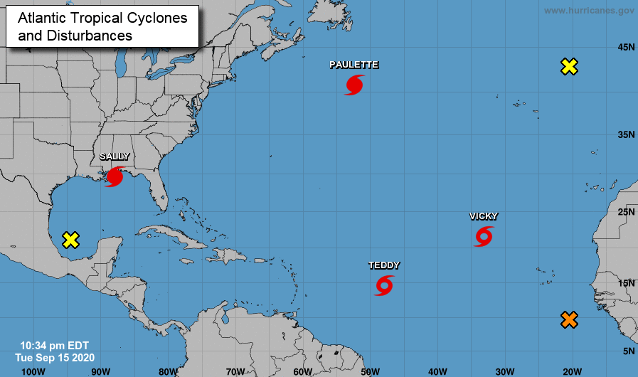
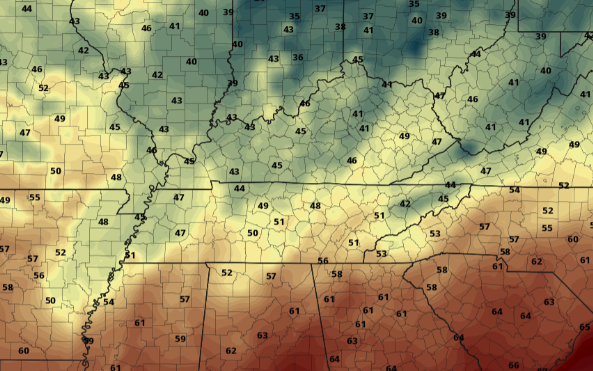
Sally has now officially made landfall in Alabama as a category 2 hurricane. Because of how slow she has moved the past couple of days, life-threatening flooding is expected in the Gulf. Sally is expected to work north and south, bringing the bulk of showers (here at home) to those farthest south and east. As seen here on model guidance, remnants of Sally will work through the heart of Alabama and Georgia. The northern edge of this system will likely bring showers throughout east Tennessee Thursday, with the heaviest and most widespread activity contained to southern and far most east Tennessee. By Friday, clearing will begin taking place the second half of the day. Sunny skies and beautiful fall-like conditions find us through the weekend and early next week. Check out the low's across the region Saturday morning! With skies quickly clearing by Friday night, overnight low's will drop into the upper 40's and lower 50's. Saturday night into Sunday morning could be even cooler with mid to upper 40's possible. Either way, that cool fall feel has arrived so take advantage! We will continue to eye Sally for rainfall amounts and impacts through the region. For now, be weary of the heaviest rainfall (& potential flooding) along the southern and eastern tips of east TN. Clearer skies work in later on Friday setting up a gorgeous weekend.
0 Comments
Leave a Reply. |
Your trusted source for everything weather in East Tennessee.
Social Media
|


