|
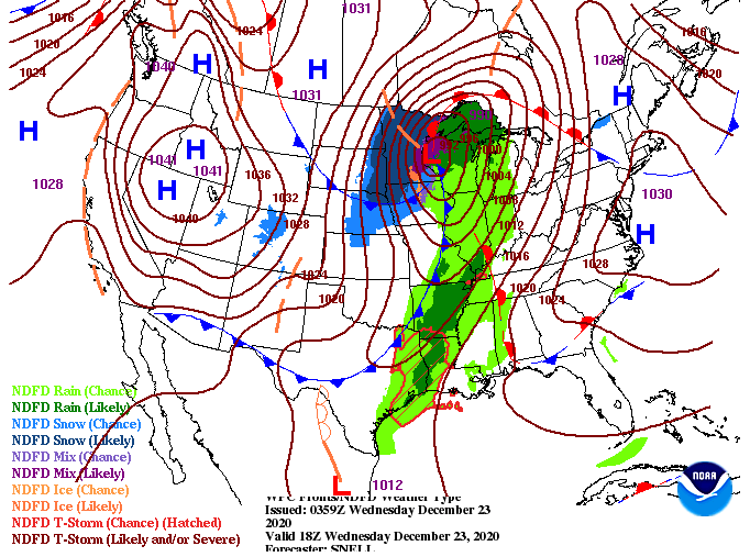
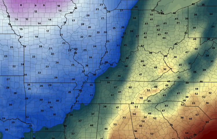
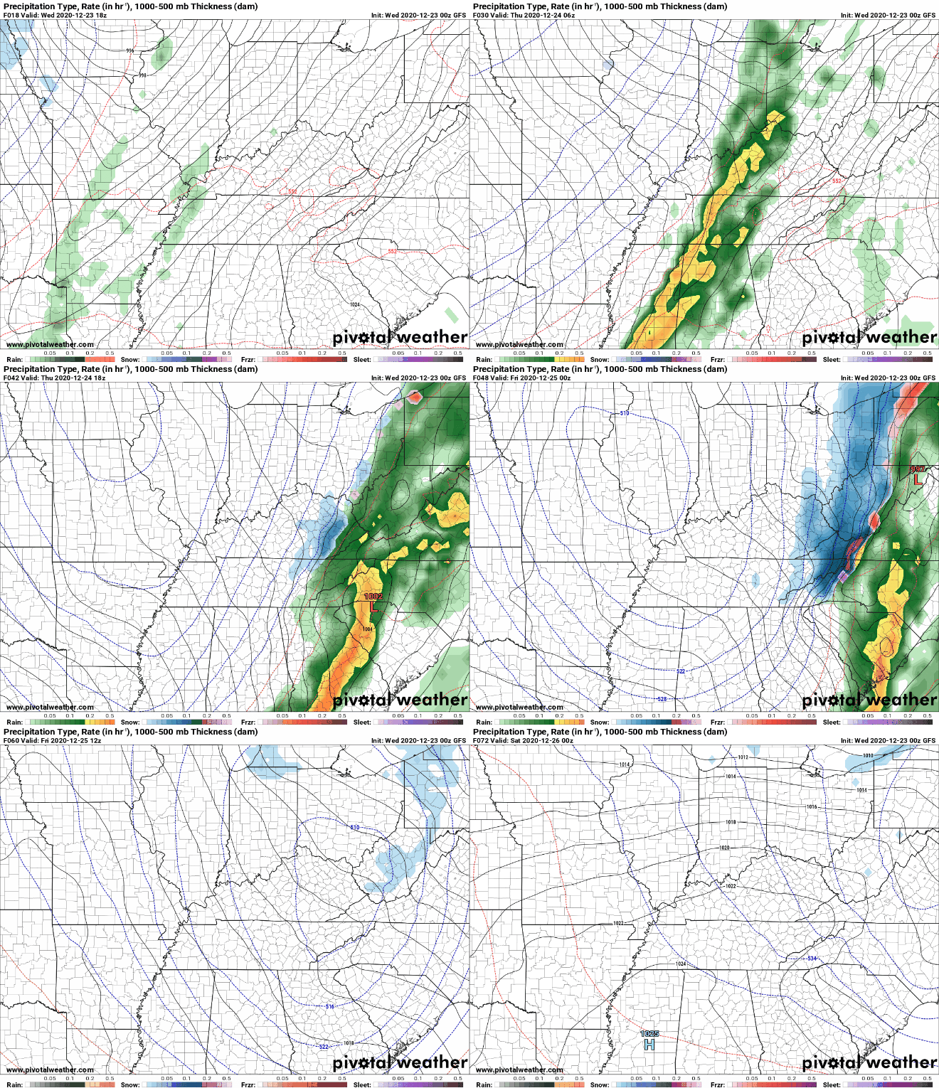
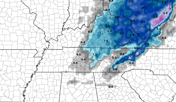
What's on the plate today weather-wise? Well, we begin this morning with some cloud cover moving in from the west. This is all associated with our next powerful system that looks to bring precipitation in many forms. As for today, cloud cover will continue to increase before showers arrive overnight. A look at Thursday afternoon (Christmas Eve), an Arctic cold front will hammer its way in from the west. This cold air mass will just be riding the back edge of the precipitation shield giving chance to some snow showers (touch more on that below). I just wanted to give you an idea of how cold things could get in such a short amount of time. Looking in Knoxville Thursday morning, temperatures will be around the 50 mark while Nashville will be in the upper 30's and 20's for far western Tennessee. Jumping into our next storm system, I will do my best to break this down. First, anticipate isolated to scattered showers this evening with heavier rainfall following into tomorrow (mid) morning. We aren't anticipating wide spread flooding by any means, but flood prone areas could see some water build-up. Showers into Thursday will be moderate to heavy with 3/4" to an inch of rain likely. Going further into detail, for the all important snow forecast, it still remains complicated. Later models, along with short term high resolution models, are trending toward a slower cold front arrival time (bad news for snow lovers). With that said, we are still nearly a day and a half out with this system currently sitting in South Dakota (as of writing this post). Model guidance does a fairly poor job of depicting these transition zones, especially with the topography we have across the region and origin of this system. With all of that said, changes still remain likely and we will continue to update you along the way. The graphic below depicts the more confident output we have moving into Christmas morning. The Central Valley and north will likely pick up anywhere between a dusting to 2 inches (likely amounts looking from the southern tip of the valley and northward). For those closer to the Smokies, 1-3" seems more reasonable with higher amounts as you work up in elevation. As is almost always the case, we will see this horseshoe shape due to topography differences. I would also like to mention some chatter from the NWS of a possible Winter Weather Advisory for the Central Valley and Plateau, so we'll let you know if they issue that as well. The NWS has issued a high wind warning for the Smokies tonight and tomorrow as strong winds are likely across the area. This will only add to the cold temperatures the second half of the day tomorrow and early into Christmas. Feel like temperatures in the single digits would not surprise me overnight Thursday. They have also put in place a winter storm watch for Thursday afternoon into Christmas morning for the Smokies and into southwest Virginia. I will continue to emphasize the dynamics associated with this system are tricky. We will monitor this throughout the day and of course overnight with a better idea of what to expect moving forward. For now, anticipate moderate to heavy rains at times tomorrow morning before a transition to snow takes place. How much snow will depend on the timing of the front. We'll be active on social media tonight, so be sure to check us out: @SecretCityWx (Twitter & Facebook). We also have some more details on your Christmas Day forecast in our daily video below. Pre-recorded for 5pm show
1 Comment
Leave a Reply. |
Your trusted source for everything weather in East Tennessee.
Social Media
|


