|
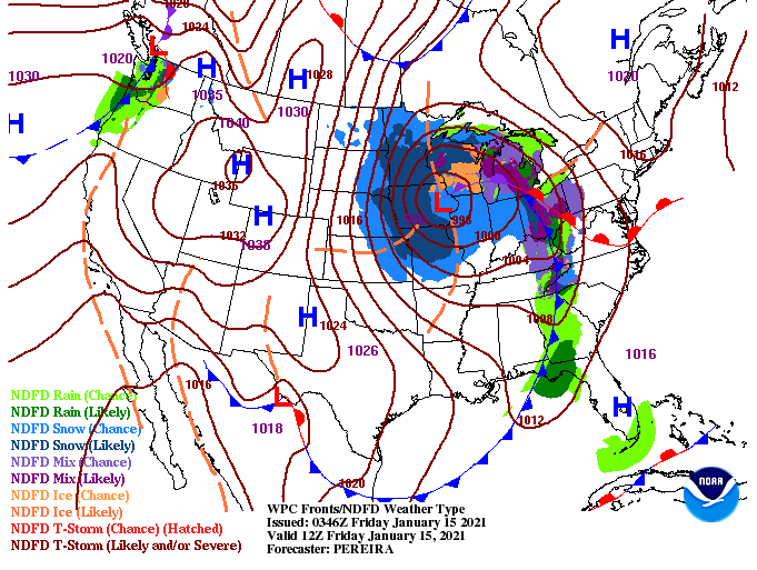
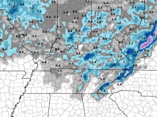
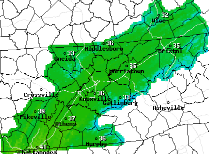
Happy Friday to everyone! We are seeing showers work through mainly east of Knoxville with some clearing in from the west. This is all apart of a low currently located to our north near the Great Lakes region. With the cold front moving just behind the leading rain shield, temperatures will stay in the 30's for much of the day. Some clearing should also set in allowing for a bit of sunshine this afternoon. As we work ahead, some changes are in store. Previous data and forecast's suggested the low to track a bit further north than it is now. With the change comes some slightly hightened snowfall chances. Wrap around moisture from the low should bring isolated to scattered snow showers through Saturday. High's will settle in the mid 30's for most Valley locations so most precipitation should be in the form of frozen matter. By Sunday, a few flurries to light showers will be possible before clearing begins overnight and into Martin Luther King Jr. Day. We look to warm back up and clear out by early next week. The big question I'm sure many are asking is: How much snow can we expect? Well, not much. With enough moisture for a few snow showers we could see an event similar to early this week with a light dusting on grassy surfaces, trees, and sitting vehicles. I don't anticipate a huge disruption to the roadways and transportation but slick spots will be likely in the morning and late evening hours Saturday/Sunday. Other areas across East Tennessee (Plateau and Foothills) can anticipate 1-3" at best Saturday into Sunday with locally higher amounts possible. If snow is in the forecast you can be sure to expect cold temperatures to accompany. A look at the NWS forecast for East Tennessee tomorrow shows high's struggling to find the upper 30's with cloud cover and wintry precipitation likely at times. Be sure to stay warm and stay safe tonight and through the weekend. If higher moisture can manage to stick around into tomorrow, we could see more impressive totals. For now, the consensus across the data doesn't suggests this solution. We'll have updates as always through the day and into the weekend! Pre-recorded for 5pm show
0 Comments
Leave a Reply. |
Your trusted source for everything weather in East Tennessee.
Social Media
|


