|
As we grow closer to the event, data is converging a bit better. With that said, there still remains some uncertainty and that will impact the outcome of the event this weekend. I will note this: the National Weather Service has issued a Winter Storm Watch for the high terrain across East Tennessee. This includes the Plateau, Foothills, Smokies, and Northern Great Valley (bordering KY). 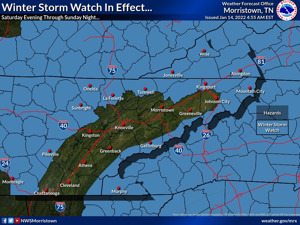 Examining probabilities for 4 inches of snow or greater, a 40-70% chance is possible for locations under the watch. There also remains a 10-40% chance for the Central Valley (Kingston up to Morristown). **So you are saying there's a chance...?** Yes, but not a big one. It's not impossible to think 4+ inches is possible across portions of the valley, but this will be very dependent on exact track, timing, intensity, and temperatures. For now, check out the break down of what we are expecting area-wide (bottom of this post) 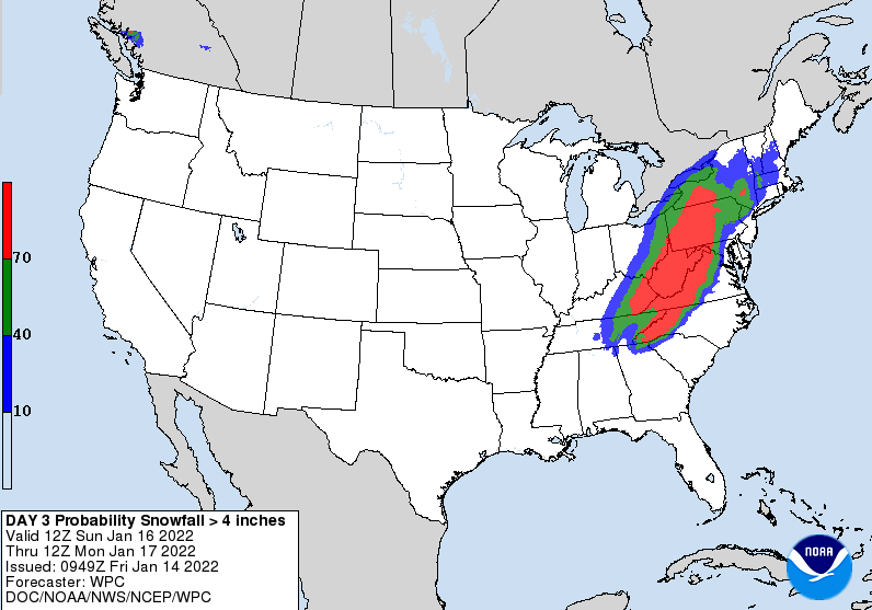 Though higher resolution data is starting to trickle in 2 days away, there remains some discrepancies in path and low development. This run depicts a more "middle ground" solution. The break down for this event will generally go as: Tonight: cloud cover increases into Saturday morning as the system works in from the north and west Saturday/Sunday: isolated to scattered rain showers during the morning to early afternoon, becoming more widespread in the evening. As temperatures fall (especially for elevated locations) a mix to snow will begin. This will continue into Sunday where a change to all snow will come Sunday afternoon and into the night (this will be the best timeframe for accumulating snow during the event). This system will exit early Monday, leaving flurries MLK Jr. Day and then gradually clearing skies and chilly (mid 30s) temperatures. 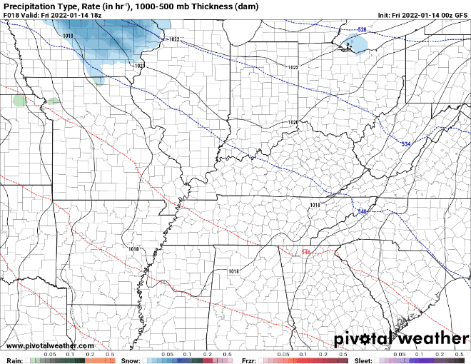 With everything now broken down a bit, here is our forecasted accumulations map: Locally higher amounts will be possible and with some uncertainties remaining these could rapidly rise in amounts or fall a touch. Either way, continue to check back in for updates and prepare ahead of time for a winter event. We'll provide you with the latest through the weekend...be sure to follow us on Twitter & Facebook (@SecretCityWx) 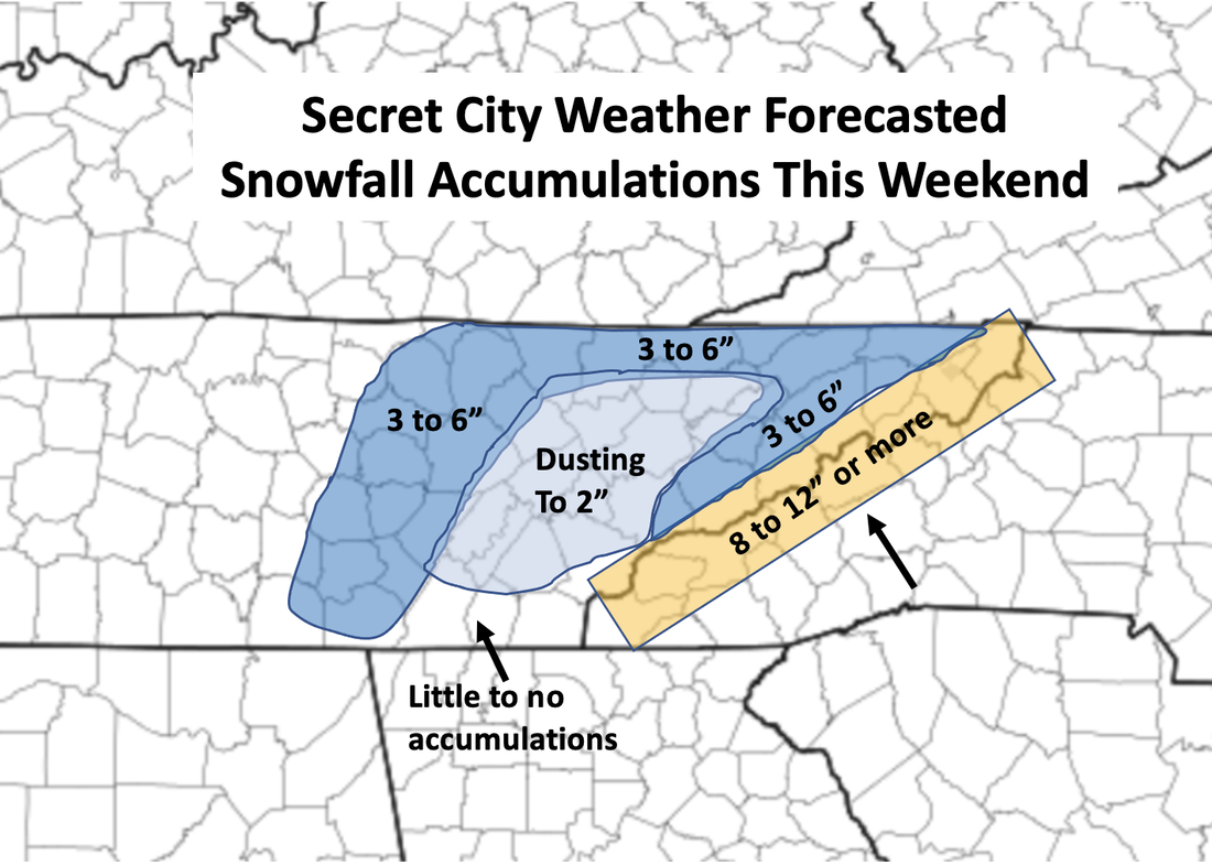 Stay safe, stay warm, and limit travel if possible this weekend. Heavier bands of snowfall are expected at times, which will impact not only roadways but also visibilities. Slow down, take your time, and plan ahead with what may be needed if roadways are shut down or slow. Send us any reports you may have as well by tagging us on our social media or by emailing at [email protected] Pre-recorded for 5pm show
0 Comments
Leave a Reply. |