|
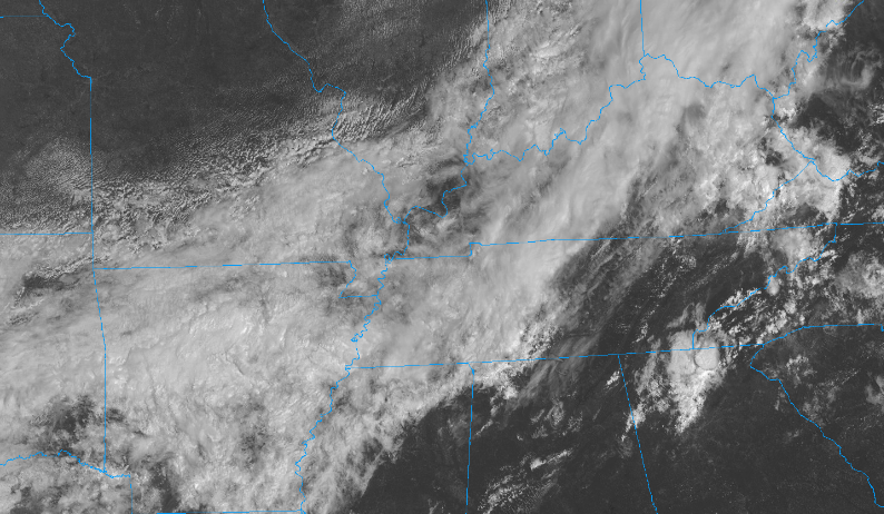
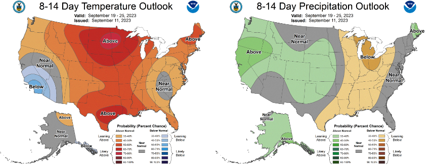
Quiet across East Tennessee now, with partly cloudy skies, but changes are coming. A cold front is slowly sliding east, bringing increased cloud cover and scattered showers/storms. No severe or hydro threat today, but pockets of heavy rainfall within thunderstorms is something to consider. Below is the latest satellite view, where thick coverage is in Middle Tennessee and west. Activity will push in, with periods of showers and storms this afternoon and evening- dissipating overnight. Following this activity will come cooler air. Clouds will be slow to exit tomorrow, but sunshine should reappear by tomorrow afternoon, where highs in the 70s can be expected- continuing through Friday. Further ahead in time, the Climate Prediction Center suggests a turn back toward drier and warmer conditions is favored. This time period is late in the month, but something to be mindful of as we move through the next couple of weeks. This is not to say no rainfall is in the forecast, but that the rainfall we pick up will generally average less than the norm for this time of the year. Showers and a few storms will work in the next couple of hours, pushing through overnight. Clouds then slowly clear out Wednesday, leaving us cooler and drier from then through Friday. A few showers then return to the forecast into the weekend. Have a good one, enjoy the beautiful weather we have after today, and don't get too excited about Fall just yet as we could have warmer air push back in during the 10-14 day period.
0 Comments
Leave a Reply. |
Your trusted source for everything weather in East Tennessee.
Social Media
|


