|
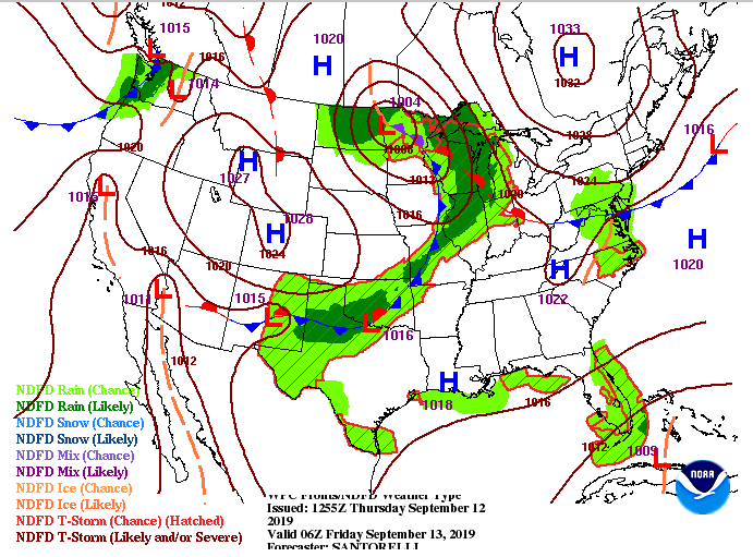
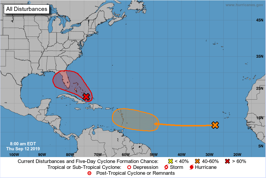
Good afternoon to everyone, pretty warm out there as of 11:30 am sitting in the mid 80's for most. By this afternoon though, we will top out in the mid 90's and have heat indices around the 100 degree mark. Our current surface map shows that high pressure system continuing to stick around, but it will begin pushing eastward today as a cold front is expected to move through late tomorrow. We will not be cooling down much though, as high's are expected to remain in the lower 90's. Our model guidance shows much of what we saw yesterday, isolated afternoon storms are possible. These will stay mostly in the higher elevations but one or two could roll through the valley late afternoon and early evening. Looking longer term, we can depict where that cold front is (linear line of rain ahead of the front). This will move through late tomorrow bringing some scattered showers to east TN Saturday. Do not be too excited for rainfall, though, as it will be quick moving and very scattered in nature. By Sunday we will have another high pressure begin building in, providing more sunshine and warm temperatures to start our work week next week. There is a tropical disturbance (or a couple) out in the Atlantic but the one we will be eyeing (around the Caribbean) could provide us some much needed rainfall next week. The NHC gives this system a greater than 60% of developing into a tropical depression or storm within the next 5 days. Depending on its path, we could see some showers by mid next week. Models are having trouble depicting its path and strength as it moves northward, so we will keep an eye on that in the coming days. Thats all we have for you today, but remember your heat safety as we will continue to stay in the 90's through early next week. You can also check out our daily video updates below or on YouTube at Secret City Weather.
1 Comment
9/12/2019 20:11:09
Christmas is near and the temperature is slowly decreasing. Coldness is in the air and we can feel that cold weather outside of our house. This is the perfect explanation for all of us to read. There are people who are always seeking for that diagram that will let them understand the true condition of the weather. We can now have an overview of the current situation. There will be no questions for us and this is a page that we can always look at. I will follow this page and wait for future announcements.
Reply
Leave a Reply. |
Your trusted source for everything weather in East Tennessee.
Social Media
|


