|
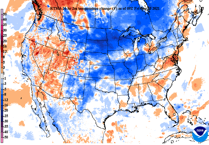
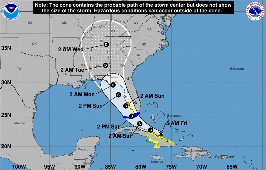
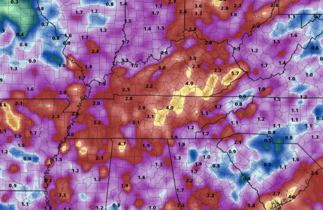
As promised, relief from the heat is on its way. A cold front is progressing from the northwest and will arrive into the weekend. With it, widespread showers & thunderstorms will work through the area (some of which could be heavy at times). The combination of rain cooled air, cloud cover, and the front will bring afternoon highs into the mid and upper 80s. Looking at now Tropical Depression Fred, the path remains relatively the same. Fred is expected to traverse just to the west of Florida before making landfall in the northern portions of the state and eventually turning east. It just so happens to work into the state of Tennessee, bringing tropical moisture to us by early to mid week. Changes are likely, but do anticipate to see some rainfall associated with Fred. Looking at the 7-day expected rainfall totals, flash flooding could be an issue. With the passage of a front, daily rainfall we have seen through the week, and a tropical system working into the region, rising waters could pose an issue. We'll keep you updated ahead, but for now enjoy some cooler air across East Tennessee. The latest drought map for this week remains relatively unchanged, so have decided to not include it in todays post. With all the rainfall expected over the next 7 days, I anticipate to return to normal conditions for much of the state by this time next week. Have a good weekend, stay dry, and don't forget to follow us on Twitter/Facebook. We'll be providing updates throughout Saturday & Sunday. Pre-recorded for 5pm show
0 Comments
Leave a Reply. |
Your trusted source for everything weather in East Tennessee.
Social Media
|


