|
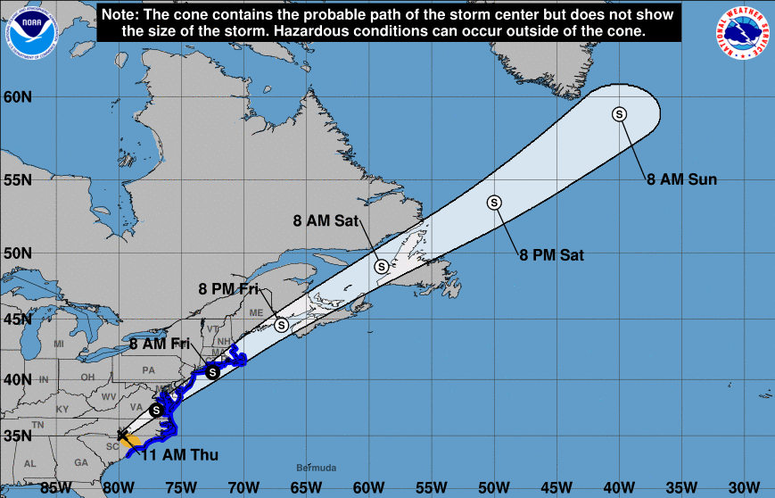
Elsa has moved quickly through the southeast and is currently in North Carolina. She will continue to work north and east, riding the eastern coastline through New England. Heavy rainfall and damaging winds continue to be the main threat with this system. As for us here in East Tennessee, a cold front sits just to the north and west. This will pester us in the days ahead bringing daily chances for showers and storms. These will primarily be in the afternoon/evening hours, but a few can't be ruled out overnight and early into the morning hours. Some drier weather will begin to again find us towards the middle of next week. Looking ahead, the CPC has released its mid-July predictions. They are expecting near-normal temperatures along with near to slight above average rain. For reference, our average high/low is 89/69 in Knoxville. Broken cloud cover and scattered showers/storms will continue to pester us Friday and through the weekend. It will be hard to pinpoint exactly when you could see activity, but most will fall in the afternoon and early evening hours. Take advantage of those "dry slots" and have a way to receive updates when showers/storms do develop. Be sure to follow us on Twitter/Facebook if you don't already by following @SecretCityWx Pre-recorded for 5pm show
0 Comments
Leave a Reply. |
Your trusted source for everything weather in East Tennessee.
Social Media
|


