|
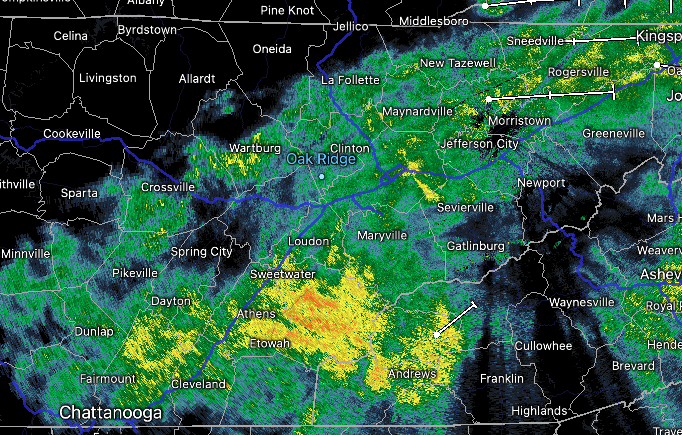
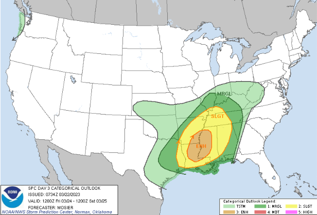
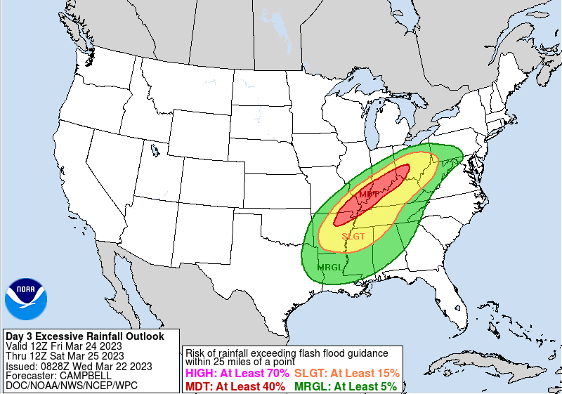
Good early afternoon! Showers are beginning to taper off from west to east, with most out just in time for the evening commute. That said, cloudy skies will hold on tight, with clearing not arriving until into Thursday. With cloud cover and showers, highs will be chilly today only topping out near the mid 50s. Fortunately, much warmer air is on the way. As this disturbance clears out into tomorrow, our next one takes shape. Looking at the severe potential according to SPC, a Marginal risk is in place. This will be a low end severe risk as the timing comes mainly into Friday night. That said, can't rule out a few strong storms heading through the evening and into the overnight with gusty winds the primary concern. The slightly bigger concern of the hazards will be flooding. Fortunately, there has been a pretty consistent trend that the axis of better precipitation will be north and west of the area. As indicated by the moderate risk across portions of Kentucky, the best of the heavy and repeated rain should miss us. This will be the pivot point of the two fronts and passing low. That said, we are not entirely out of the woods, as heavy downpours in addition to what we see today and leading up to Friday night could create some localized issues. Rainfall amounts Friday afternoon through Saturday morning will vary between 0.5-1". Both hazards: severe & flooding are low chances. Even so, take precautions now as there is that low end risk. As far as the play by play, showers end over the next couple of hours, with clearing skies into Thursday. Dry weather is in the plans for tomorrow, before showers return the later half of the day Friday. The best chances will be just ahead of the front Friday night to early Saturday, before clearing and drying out through the weekend. Shower chances then return Sunday night into early next week. Pre-recorded for 5pm weather broadest
0 Comments
Leave a Reply. |
Your trusted source for everything weather in East Tennessee.
Social Media
|


