|
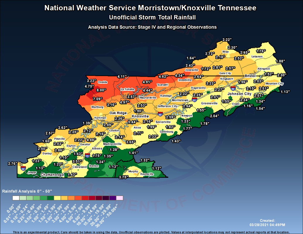
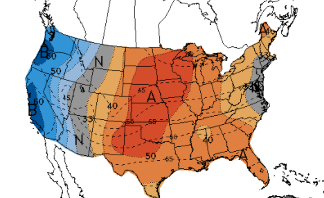
After an eventful weekend, here are the unofficial rain totals from the NWS. Significant rain fell across the Plateau with some locations near Oneida with well over half a foot recorded. This led to numerous flash flood warnings and advisories through the weekend and even into the day today. Working ahead, another system will bring moderate rainfall (at times) Tuesday night and Wednesday. This could lead to additional flash flooding & flooding across the region, given the saturated soils we already have. Fortunately, our two-day dry spell with lots of sunshine should assist in lessoning those odds. Nonetheless, the WPC has placed East Tennessee under a Marginal risk for flash flooding on Wednesday. Conditions clear and COOL back out Thursday through the weekend. Short-term a cold spell is set to return later in the week. Our next weather maker will have a trailing cold front looking to knock high temperatures into the mid 40's for most. Overnight low's will be in the 20's and 30's Wednesday to the weekend. This is a heads up now to protect & cover any plants you may have for the new growing season. Longer term, April looks to be a warm and dry one. The latest from the CPC suggests above average temperatures and less than average rainfall through the middle of the month. That will wrap it up for the day....Don't be surprised to see high's Thursday and Friday nearly 20 degrees below average. A strong front will slide through bringing less than ideal temperatures for this time of the year. More information can be found on our daily video forecast below. Pre-recorded for 5pm show
0 Comments
Leave a Reply. |
Your trusted source for everything weather in East Tennessee.
Social Media
|


