|
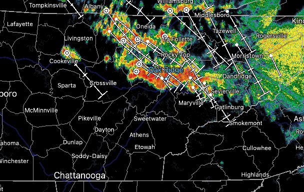
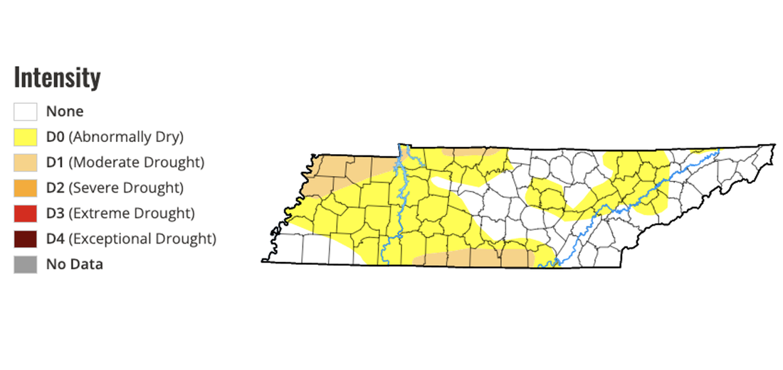
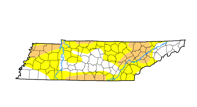
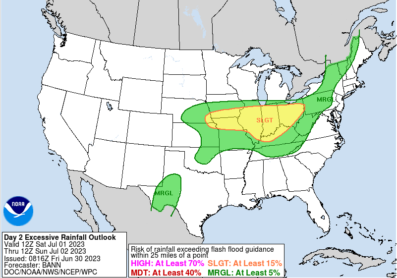
Good morning! For those heading out the door, have your umbrellas handy. Also account for some extra travel times with the wet roads and heavy rains resulting in reduced visibilities. This is the latest (8 am) radar scan, with activity heading south and east with time. The good news is this should all clear out by mid morning, setting up partly cloudy skies for the greater portion of the day. Another bout of similar activity looks to return this evening into the night. Some storms could be strong to severe with this (later today) cluster. Switching things up a bit, check out the improvement across our neck of the woods. After some much needed rainfall the past couple of weeks, things are starting to veer back to normal. We have lost moderate drought conditions across East Tennessee, but still hold onto a few areas of abnormally dry spots. Fortunately, the unsettled pattern we are in should quickly fix that, with further improvement fully expected in the next release. As highlighted above, severe storm chances will haunt us today through Sunday, where damaging wind gusts are the primary threat. That said, large hail also can't be ruled out. Another aspect to this is the flash flooding threat. With rounds of showers and storms over the next few days, this could lead to isolated flooding. This is highlighted below for Saturday from WPC, but a marginal risk encompasses the area today, tomorrow, and Sunday. Our best and most widespread rainfall chances will be Sunday with an approaching cold front. Lingering chances then stick around much of next week as well, mainly during the afternoon and evening hours each day. Stay up to date on the latest by following our social media (@SecretCityWx) on Twitter and Facebook. Stay safe, have a way to receive warnings if they were to be issued in the days ahead, and stay cool from the sweltering heat and humidity. Highs will peak in the upper 80s to low 90s today and through the weekend, with feel like temperatures closer to 100 and greater for some (particularly in the south).
0 Comments
Leave a Reply. |
Your trusted source for everything weather in East Tennessee.
Social Media
|


